by Turo
posted on August 14, 2025
The Vancouver to Las Vegas drive takes you through some of the most varied and scenic terrain in the Western United States. This road trip guide shares practical driving tips and five standout stops that add more character, colour, and purpose so the journey feels just as rewarding as the destination!
In this guide, we’ll be covering:
- Tips for driving from Vancouver to Las Vegas
- How are the road conditions between Vancouver and Las Vegas?
- What is the best time of year to drive from Vancouver to Las Vegas?
- Are there EV chargers along the way between Vancouver and Las Vegas?
- Where to stop while driving from Vancouver to Las Vegas
- Frequently asked questions about the Vancouver to Las Vegas road trip
- Book your rental car in Vancouver with Turo
Tips for driving from Vancouver to Las Vegas
Stick to Interstate 5 through Washington and Oregon before merging with I-15 south in California. It’s a long haul – just over 1,800 km and around 20 hours – so plan for fuel, food, and overnight rest. Have your travel documents ready for the U.S. border crossing.
How are the road conditions between Vancouver and Las Vegas?
Road quality is solid from end to end. Expect city traffic around Seattle and Portland, then mostly open freeways. Mountain passes and desert stretches can bring changing weather, so check forecasts and carry water, especially in Nevada and southern Utah.
What is the best time of year to drive from Vancouver to Las Vegas?
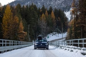
Late spring and early fall offer cooler temperatures and fewer crowds at major attractions. Summer is popular but hot, especially as you near Vegas. Winter can bring snow to mountain routes, so pack accordingly if travelling between November and March.
Are there EV chargers along the way between Vancouver and Las Vegas?
There’s a reliable network of fast chargers through Washington, Oregon, and California. Major corridors like I-5 and I-15 are EV-friendly, with stops in most towns and cities along the way. Just plan your charge points in advance for the longer stretches.
Where to stop while driving from Vancouver to Las Vegas
This epic Las Vegas road trip covers a lot of ground and just as much variety. With the right stops, you can fill your long drive with local flavour, natural landmarks, and a few places you’ll want to linger a little longer.
Pike Place Market, Seattle

This historic waterfront market in downtown Seattle is a vibrant first stop just after crossing the border. With food stalls, local artists, and a view of Elliott Bay, it’s a welcome contrast to the highway.
- Distance from Vancouver: 230 km (~3 hours)
- Distance to Las Vegas: 1,570 km (~17 hours)
Why it’s great
Fresh seafood, live music, and unique local shops make this a great place to stretch your legs and pick up something you won’t find at a rest stop.
Practical tips
Mornings are quieter and easier to navigate. Parking fills up fast, so aim for a weekday or off-peak hour. If you’re hungry, head straight for the lower levels for fewer crowds.
How to get there
From Vancouver, head south on I-5 and follow signs into downtown Seattle. If you’re flying in, a Vancouver airport car rental lets you skip the lineups and start your trip right away. If you’re taking the kids on a road trip, a minivan from brands like Chrysler or Nissan will have the space and entertainment options you need to keep everyone happy.
Columbia River Gorge National Scenic Area
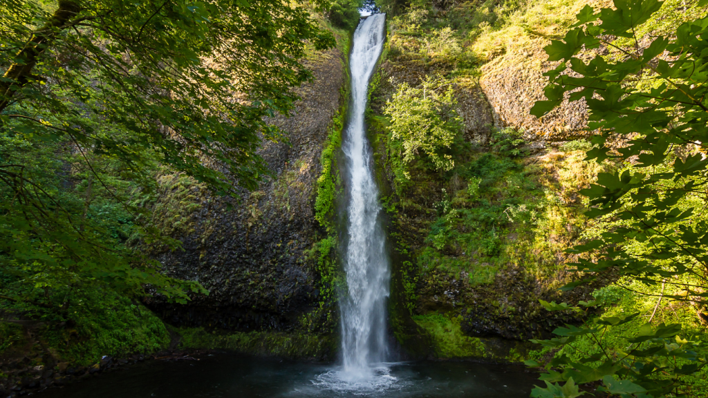
Cutting between Oregon and Washington State, stop at the Columbia River Gorge for waterfalls, basalt cliffs, and winding hiking trails with wide-open views. It’s a solid midday break, but give yourself some time to explore.
- Distance from Vancouver: 600 km (~6.5 hours)
- Distance to Las Vegas: 1,200 km (~12.5 hours)
Why it’s great
You don’t need to go far from the highway to find a great view. Take a short hike or pull over at a viewpoint and just soak it in for a bit.
Practical tips
Plan for at least an hour here. Multnomah Falls has a nearby lot, but it fills quickly on weekends. Weekdays are easier, and most trailheads have restrooms and basic signage.
How to get there
Take I-5 south through Portland, then head east on I-84 along the Columbia River. This is one of the most EV-friendly legs of the trip, with fast chargers in Troutdale, Hood River, and The Dalles. If you rent an electric vehicle like a Tesla or Chevrolet, this is a great spot to charge up.
Perrine Bridge, Idaho
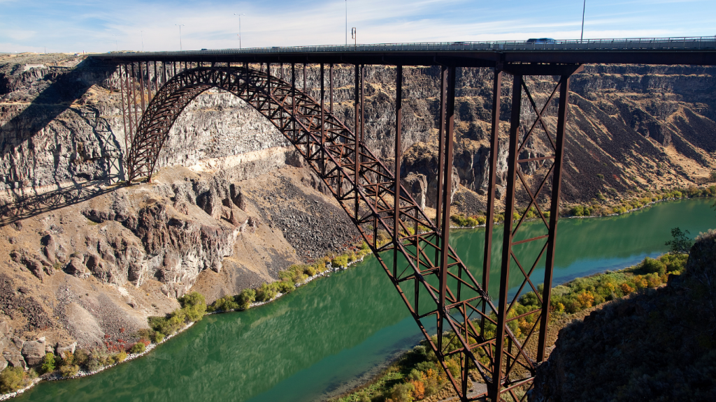
Spanning the Snake River Canyon in southern Idaho, Perrine Bridge is one of the most scenic overlooks on the drive. It’s also one of the few legal BASE jumping sites in the U.S.!
- Distance from Vancouver: 1,100 km (~11.5 hours)
- Distance to Las Vegas: 700 km (~7 hours)
Why it’s great
You can walk across the bridge for stunning views of the canyon or stop at the visitor center to learn more about the area’s geology and history.
Practical tips
Parking is easy, and the walking path is wide, but the wind can pick up fast. If you’re hoping to see a jump, early mornings offer the best chance. There’s a trail beneath the bridge that leads to even better views.
How to get there
Stay on I-84 east through southern Idaho and exit at Twin Falls. The drive into town is straightforward, but the surrounding trails and overlooks are better with a vehicle that handles changeable terrain. A capable SUV from brands like Subaru, BMW, or Jeep is a great choice here.
Lake Tahoe
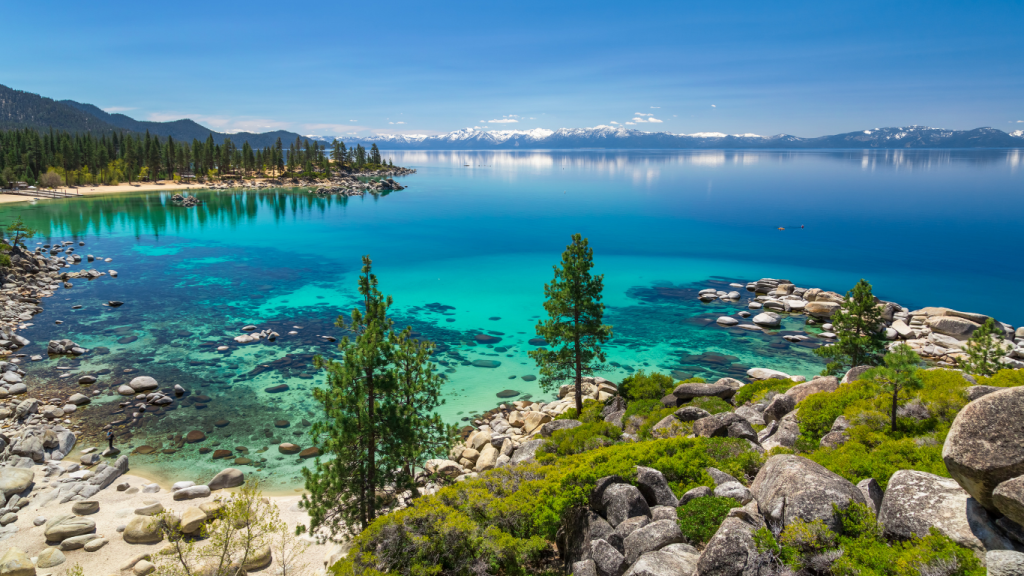
Tucked into the Sierra Nevada, Lake Tahoe is a welcome shift from over 12 hours of freeway driving. The mountain roads, lakeside views, and slower pace make it an easy place to spend a little more time.
- Distance from Vancouver: 1,500 km (~15 hours)
- Distance to Las Vegas: 550 km (~6 hours)
Why it’s great
Clear water, mountain air, and a scenic drive through the Sierra Nevada make this one of the most Instagrammable stretches of the route.
Practical tips
Summer weekends are busy, and accommodations book up fast. Fuel up before heading into the mountains and check for roadwork, especially in spring or late fall.
How to get there
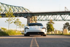
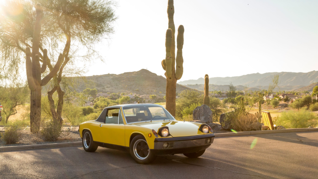
Follow I-80 east into Reno, then head south along US-395. In a place this pretty, you’ll want to drive something equally as beautiful. Renting a luxury car, sports car, or classic car makes the winding roads part of the experience. Models from Porsche or Mercedes-Benz fit right in here, and you’ll love every minute.
Zion National Park, Utah
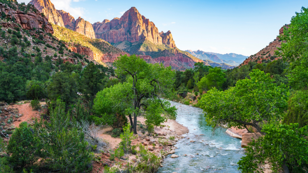
Massive sandstone walls, narrow slot canyons, and desert trails that twist through towering cliffs. Zion doesn’t look or feel like anywhere else. It’s one of the most awe-inspiring places you’ll pass before reaching Las Vegas.
- Distance from Vancouver: 1,950 km (~20 hours)
- Distance to Las Vegas: 260 km (~2.5 hours)
Why it’s great
Zion’s beauty rivals some of the best national parks in BC. You can do a short walk or spend the whole day exploring.
Practical tips
Shuttles run from Springdale into the main canyon during high season. Parking fills fast near the visitor center, so arrive early. Cell service is limited, and weather can shift quickly in the canyons.
How to get there
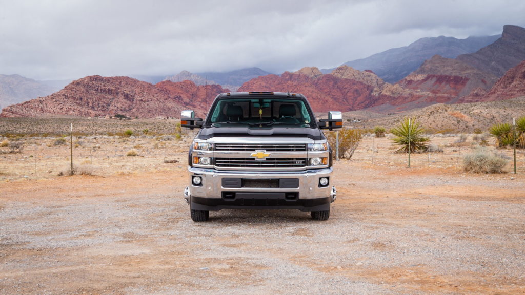
Take I-15 south and exit near Springdale. Zion’s terrain and distance from major cities make it worth driving something rugged. An SUV or pickup truck gives you space for camping gear or hiking equipment. Vehicles from Ford, Toyota, or anything with all-wheel drive offer extra peace of mind on rougher roads.
Frequently asked questions about the Vancouver to Las Vegas road trip
Where is Las Vegas?
Las Vegas is in southern Nevada, right in the Mojave Desert, near the borders of California and Arizona. It’s about 420 km (260 miles) northeast of Los Angeles and sits at the intersection of I-15 and several major U.S. highways.
Most visitors fly into Harry Reid International Airport, just ten minutes from the Strip. Book your Vancouver or Las Vegas airport car rental with Turo, grab your bags and hop behind the wheel to start your adventure!
What’s the fastest route from Vancouver to Las Vegas?
The most direct route is I-5 south to California, then east on I-15 through the Mojave. It’s paved the whole way and well-signed, with gas, food, and rest stops in every major city. Without traffic, it’s the most reliable way to get there on time.
What’s halfway between Vancouver and Las Vegas?
Southern Idaho is a natural halfway point, with cities like Twin Falls offering food, fuel, and places to stay. You’ll also find scenic detours nearby, like Snake River Canyon and Shoshone Falls.
How long does it take to drive from Vancouver, BC to Las Vegas?
The drive covers roughly 1,800 km and takes about 18 to 20 hours behind the wheel. Your total time will depend on how often you stop and where you cross the border—Peace Arch and Pacific Highway are the most common options.
Is it cheaper to drive or fly to Las Vegas?
It depends on how you travel. Flights can be quicker, but driving gives you flexibility and a front row seat to all the Western U.S. has to offer. If you’re splitting fuel costs with others or planning to explore along the way, driving often makes more sense financially and adds more to the experience.

Book your rental car in Vancouver with Turo
Your Vancouver road trip doesn’t have to start with a long lineup or a mystery vehicle. On Turo, you get the car you actually want, delivered where it makes the most sense for you. So start packing your bags and get ready for a drive you’ll remember forever!
Feeling inspired? Pitch a Trip and let Turo sponsor your vehicle rental to turn this adventure into a reality! Whether you’re a storyteller, photographer, or just love to travel, this could be your chance to share your experience with the world.