by Turo
posted on April 1, 2026
The St. John’s to Halifax drive connects Newfoundland’s dramatic coastline with Nova Scotia’s historic harbours in one unforgettable journey through Atlantic Canada. This road trip guide helps you plan the route, handle the ferry crossing, and discover memorable places along the way!
In this guide, we’ll be covering:
- Tips for driving from St. John’s to Halifax
- How are the road conditions between St. John’s and Halifax?
- What is the best time of year to drive from St. John’s to Halifax, NS?
- Are there EV chargers along the way between St. John’s and Halifax?
- Where to stop while driving from St. John’s to Halifax, Nova Scotia
- Frequently asked questions about the St. John’s to Halifax road trip
- Book your rental car in St. John’s with Turo

Tips for driving from St. John’s to Halifax
The St. John’s to Halifax drive covers roughly 1,750 kilometres, including a ferry crossing from Newfoundland to Nova Scotia. Total travel time usually lands between 22 and 26 hours, so breaking the trip into a few days keeps it relaxed.
How are the road conditions between St. John’s and Halifax?
You’ll follow the Trans-Canada Highway across Newfoundland before boarding the ferry, then continue on well-maintained highways through Nova Scotia. Roads stay paved and clearly marked, but expect winding coastal sections, changing weather, and occasional construction.
What is the best time of year to drive from St. John’s to Halifax, NS?
July and August bring the warmest weather, while June and September feel quieter and easier to navigate. Winter travel is possible if you’re experienced with cold-weather driving, but storms and ferry delays can affect your plans.

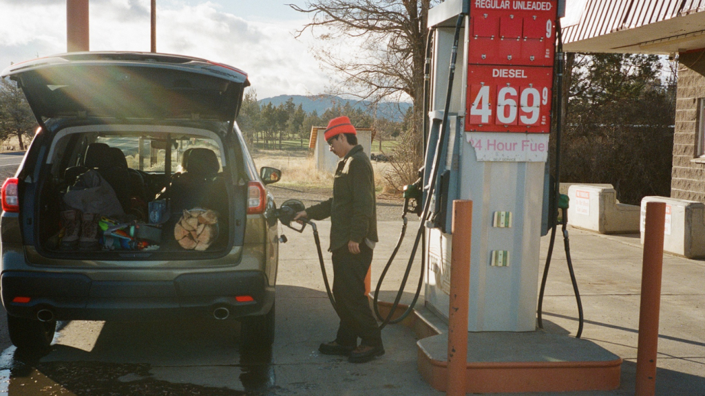
Are there EV chargers along the way between St. John’s and Halifax?
Charging networks are growing across Atlantic Canada, but if you’re interested in driving an electric vehicle, some extra planning goes a long way. If you map out your charging stops ahead of time, it’s easy to keep things eco-friendly as you discover the Maritimes and Newfoundland!
Where to stop while driving from St. John’s to Halifax, Nova Scotia
Driving from St. John’s to Halifax is a chance to explore the coastlines, national parks, and small towns that make Atlantic Canada so special. These five stops will give you plenty of reasons to slow down and take it all in.
Terra Nova National Park, Newfoundland and Labrador
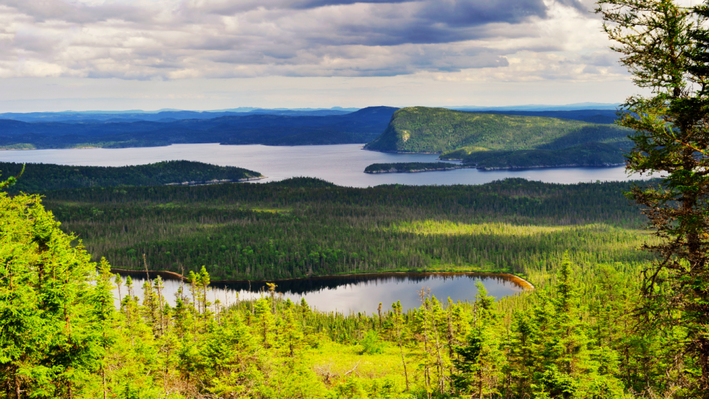
Terra Nova National Park sits along Newman Sound, where Route 1 runs past sheltered coves, rocky shorelines, and dense boreal forest. Stop near the Visitor Centre or pull off at Malady Head Trail for a short coastal walk with clear views across the water.
- Distance from St. John’s: ~230 km (about 2.5 hours)
- Distance to Halifax: ~1,520 km (about 20–23 hours, including ferry)
Why it’s great
Step out onto marked trails and quiet roadside lookouts within minutes of the highway, and you’ll get to see Newfoundland’s coastline up close without committing to a long detour.
Practical tips
Watch for moose along Route 1, especially in the early morning or evening. The Visitor Centre has restrooms and maps if you want to plan a longer stop.
How to get there
Follow the Trans-Canada Highway (Route 1) west from St. John’s and take the signed exits near Glovertown. Booking a St. John’s airport car rental on Turo lets you leave the airport and head straight onto the open road. Renting an SUV from Toyota or Ford gives you space for bags and easy access to trailheads and roadside pull-offs along Newman Sound.
Gros Morne National Park, Newfoundland and Labrador
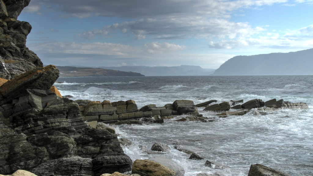
Stretching along Newfoundland’s west coast, where the Tablelands rise in rust-coloured layers, is Gros Morne National Park. This is one of the most impressive parks in the country, and it deserves a spot on your ultimate Canadian bucket list.
- Distance from St. John’s: ~700 km (about 8–9 hours)
- Distance to Halifax: ~1,050 km (about 14–17 hours, including ferry)
Why it’s great
You’re driving through a UNESCO World Heritage Site with clearly marked access points to major landmarks like the Tablelands Trail and Western Brook Pond.
Practical tips
Fuel up in Deer Lake before heading into the park, as distances between services can be longer. Weather changes quickly near the coast, so bring layers even on clear days.
How to get there
Stay on the Trans-Canada west, then follow Route 430 north toward Gros Morne National Park. An all-wheel drive vehicle helps keep the drive steady through changing weather and coastal winds. Models from Subaru or Jeep handle longer distances comfortably while giving you the control you want on exposed sections of the park.
North Sydney, Nova Scotia
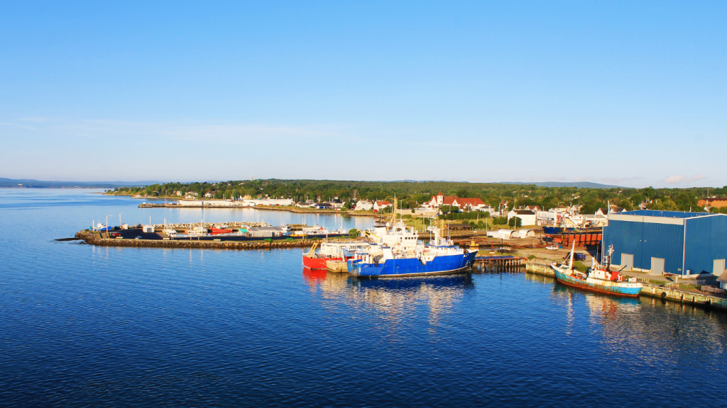
North Sydney is where the Marine Atlantic ferry docks after crossing from Newfoundland, placing you right on Cape Breton’s northeastern edge. The waterfront near Commercial Street, the ferry terminal, and nearby Seaview Park give you space to step out, stretch, and reset before continuing the drive.
- Distance from St. John’s: ~900 km + ferry (about 16–20 hours total)
- Distance to Halifax: ~400 km (about 4.5 hours)
Why it’s great
This is the transition point between provinces. You’re arriving by ferry, rejoining the highway network, and setting up the next leg of your drive through Nova Scotia.
Practical tips
Be sure to check departure and arrival times in advance. Fuel stations and restaurants are close to the terminal, so fill up the car and your belly before heading out.
How to get there
Take the Marine Atlantic ferry from Port aux Basques or Argentia to North Sydney. Once you arrive, follow local signs from the terminal to connect with Highway 105. If you’re travelling with kids or as a group, a van or minivan rental, like models from Chrysler or Mercedes-Benz, will give everyone space to spread out comfortably.
Cape Breton Highlands National Park, Nova Scotia
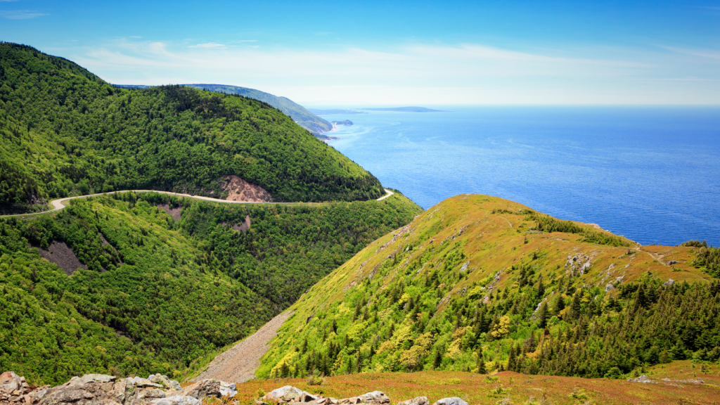
Cape Breton Highlands National Park follows the Cabot Trail along steep coastal cliffs, with lookouts over the Gulf of St. Lawrence and marked hikes like Skyline Trail near Cheticamp. Route 30 winds through the park, with frequent pull-offs where you can stop and take in the views.
- Distance from St. John’s: ~1,050 km + ferry (about 18–22 hours total)
- Distance to Halifax: ~350 km (about 4 hours)
Why it’s great
You’re driving one of Canada’s most recognized scenic routes, with consistent access to viewpoints, trailheads, and coastal sections that stay close to the road.
Practical tips
Weather shifts quickly along the coast, especially at higher elevations. Fuel up before entering the park, and allow extra time for stops since traffic slows near popular lookouts and trailheads.
How to get there
From North Sydney, follow Highway 105 west, then connect to Route 30 near Baddeck. Charging stations in Baddeck and Cheticamp make this one of the more practical sections of the trip for an electric vehicle. Renting a Tesla or a model from Chevrolet lets you take advantage of nearby chargers while enjoying a quiet, steady drive along the Cabot Trail.
Peggy’s Cove, Nova Scotia
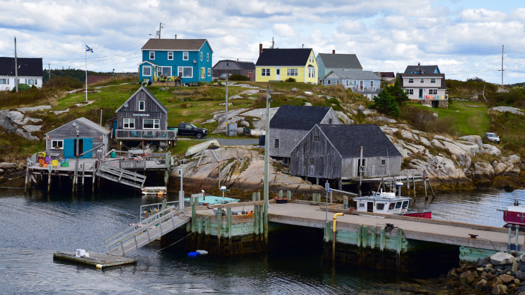
Peggy’s Cove sits along Nova Scotia’s South Shore, where the Peggy’s Point Lighthouse stands on smooth granite rock facing the Atlantic. Wooden fishing stages, anchored boats, and fresh seafood make this village a quintessential part of the Nova Scotia summer seaside.
- Distance from St. John’s: ~1,400 km + ferry (about 22–26 hours total)
- Distance to Halifax: ~45 km (about 45 minutes)
Why it’s great
You can walk directly along the granite shoreline to the lighthouse and explore a working fishing village that’s full of energy and hospitality.
Practical tips
Parking fills quickly, especially mid-day and in summer. Surfaces are uneven and can be slippery near the water, so wear stable shoes and keep a safe distance from the waves.
How to get there
Take Highway 103 west, then exit onto Route 333 toward Peggy’s Cove. It’s an easy drive, but one you’ll want to enjoy, not rush through. This is the perfect spot to get behind the wheel of something special. Driving a classic car, sports car, or exotic car like a Porsche can turn a short coastal run into something you’ll remember long after you leave.
Frequently asked questions about the St. John’s to Halifax road trip
Where is Halifax?
Halifax is the capital of Nova Scotia, located on the province’s central Atlantic coast along one of the world’s largest natural harbours. It sits about 300 km south of Cape Breton and serves as a key hub for travel across Atlantic Canada.
Most travellers arrive through Halifax Stanfield International Airport, about 30 minutes from downtown. If you’re flying in, book a Halifax airport car rental with Turo, and you can head out on the road as soon as you grab your bags!
Can you drive from Newfoundland to Nova Scotia?
Not entirely by road. Newfoundland is an island, so you’ll need to take a Marine Atlantic ferry to cross the Cabot Strait into Nova Scotia before continuing your drive.
How do you get from Newfoundland to Halifax?
Drive across Newfoundland on Route 1, then take the ferry from Port aux Basques or Argentia to North Sydney. From there, it’s about a 4.5-hour drive south to Halifax on Highway 105 and Highway 102.

How long does it take to drive from St. John’s to Halifax?
The full trip usually takes between 22 and 26 hours, depending on your ferry route, stops, and driving pace. Most people spread it over several days to make time for stops along the way.
What is the best month to go to Halifax?
July and August bring warm weather and the busiest events calendar, while June and September offer milder temperatures and fewer crowds. Early fall is a great choice if you want comfortable conditions without peak-season traffic.

Book your rental car in St. John’s with Turo
Start your ultimate Maritime road trip on your terms. With Turo, you choose the exact car that fits how you want to travel, line up delivery to the airport or your doorstep, and head straight onto Route 1 without waiting in line or settling for what’s left on the lot!
Feeling inspired? Pitch a Trip and let Turo sponsor your vehicle rental to turn this adventure into a reality! Whether you’re a storyteller, photographer, or just love to travel, this could be your chance to share your experience with the world.