by Turo
posted on November 19, 2025
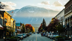
The Calgary to Las Vegas drive takes you from open prairie skies to red rock deserts, across six states with every kind of scenery in between. This road trip guide keeps things simple: a few solid tips to keep things smooth and five stops that make the miles more rewarding.
In this guide, we’ll be covering:
- Tips for driving from Calgary to Las Vegas
- How are the road conditions between Calgary and Las Vegas?
- What is the best time of year to drive from Calgary to Vegas?
- Are there EV chargers along the way between Calgary and Las Vegas?
- Where to stop while driving from Calgary to Las Vegas
- Frequently asked questions about the Calgary to Las Vegas road trip
- Book your rental car in Calgary with Turo
Tips for driving from Calgary to Las Vegas
It’s a long haul; roughly 1,900 km and about 19 hours of driving. You’ll cross the border early, so have your passport ready for inspection. Split the route into three or four days so you can rest, refuel, and enjoy more of what makes trips like this special.
How are the road conditions between Calgary and Las Vegas?
Highways stay well-maintained from Alberta through Nevada, with fuel stops all along I-15. Expect changing conditions near the Rockies and the desert farther south. Keep fluids topped up and check tire pressure before crossing into higher elevations.
What is the best time of year to drive from Calgary to Vegas?
Spring and fall offer the best mix of clear skies and mild temperatures. Summer can push 40°C across Nevada, and winter brings snow near the Montana border. Plan for daytime drives to enjoy the views and avoid icy mornings.
Are there EV chargers along the way between Calgary and Las Vegas?
Yes, plenty. Fast chargers line I-15 through Montana, Utah, and Nevada. Major hubs like Great Falls, Salt Lake City, and St. George make this route one of the easiest for EV travel, so if you’ve always been interested in electric cars, rent a long-range model and get out there!
Where to stop while driving from Calgary to Las Vegas
Driving from Calgary to Las Vegas takes you through wide-open prairies, mountain passes, and desert highways that seem like they might go on forever. These five stops give you space to stretch, explore, and make the road the best part of the trip.
Glacier National Park, Montana
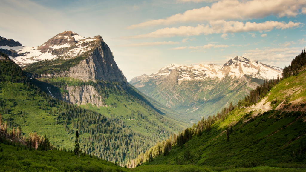
Just south of the Alberta border, Glacier National Park is the first major landmark on the route. Alpine lakes, razor-edged mountains, and twisting roads create an unforgettable early stop.
- Distance from Calgary: 290 km (~3.5 hours)
- Distance to Las Vegas: 1,600 km (~16 hours)
Why it’s great
Towering peaks and mirror-still lakes make every overlook worth stopping for. It’s an early taste of the wild terrain ahead.
Practical tips
Pack warm layers. Even in the summer, high elevations get cold. Fuel and food become limited deeper into the park.
How to get there
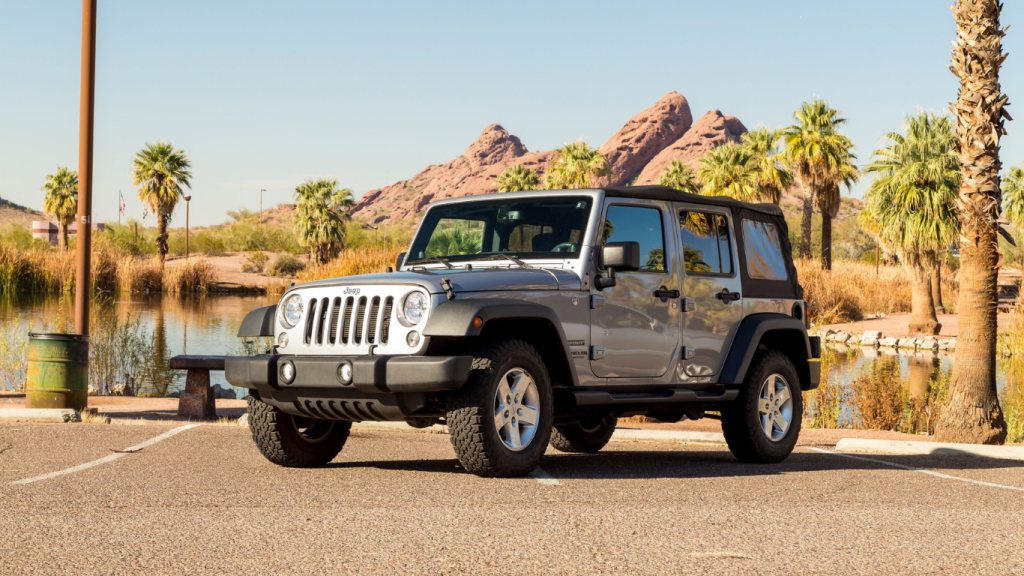
Take Highway 2 south from Calgary, then follow US-89 to St. Mary. All-wheel drive vehicles like Jeep and Subaru models handle elevation changes with ease.
Salt Lake City, Utah
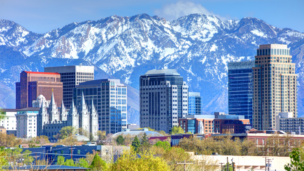
Set against the Wasatch Mountains, Salt Lake City is the perfect midpoint on the drive. It’s big enough for a full rest day, with plenty of food, music, and activities to recharge before the desert stretch ahead.
- Distance from Calgary: 1,250 km (~12.5 hours)
- Distance to Las Vegas: 680 km (~6.5 hours)
Why it’s great
Downtown is compact and full of character. It’s easy to explore on foot, with quick detours to the foothills or the Great Salt Lake nearby.
Practical tips
Parking downtown can be tight near event venues and hotels, so plan ahead or park a few blocks away. Stay central to make the most of your downtime.
How to get there
Follow I-15 south through Idaho into Utah and take the downtown exits near Temple Square. Smaller rental cars like sporty BMW or Nissan models make city driving and tight parking easier.
Bryce Canyon National Park, Utah
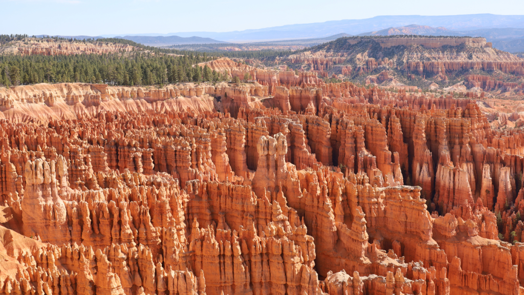
Carved over millennia by wind and rain, Bryce Canyon is a surreal amphitheatre of red and orange spires. Sunrise or sunset paints the hoodoos gold, making the detour absolutely worth it.
- Distance from Calgary: 1,550 km (~15.5 hours)
- Distance to Las Vegas: 420 km (~4.5 hours)
Why it’s great
The viewpoints are easy to reach and close together, so you can see plenty without committing to a full-day hike. Its beauty is right up there with the best parks in Alberta.
Practical tips
Bring water, sunscreen, and layers. The park is gorgeous but exposed, and scenic turnouts fill up quickly in summer.
How to get there
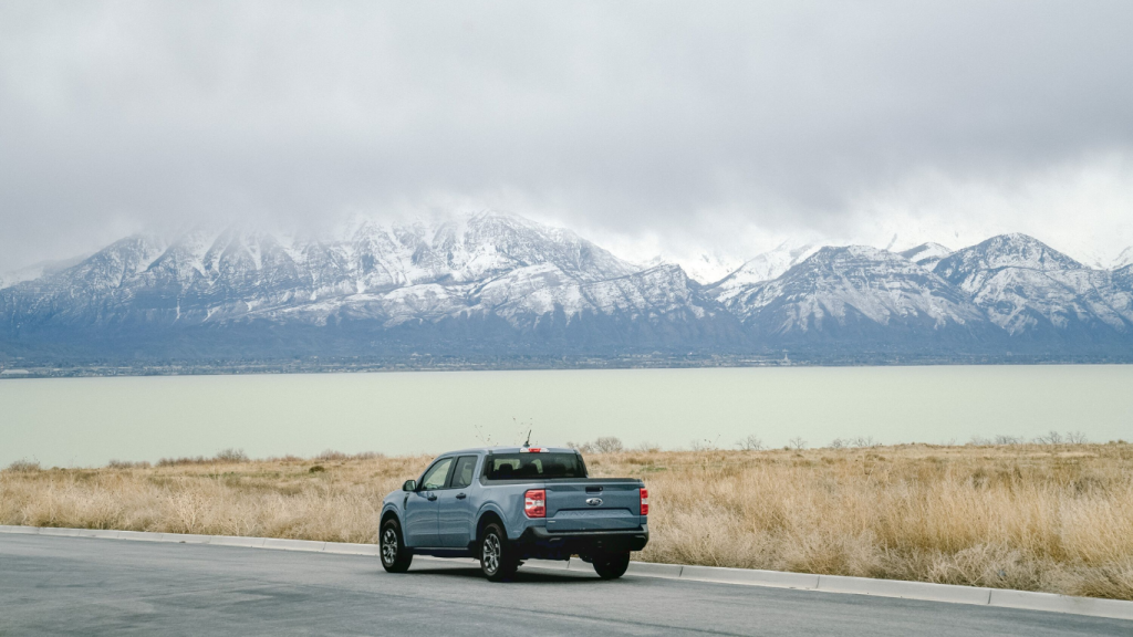
Take I-15 south to UT-20, then US-89 and UT-12. An SUV, Jeep, or pickup truck gives you great clearance for gravel pullouts and uneven shoulders.
Zion National Park, Utah
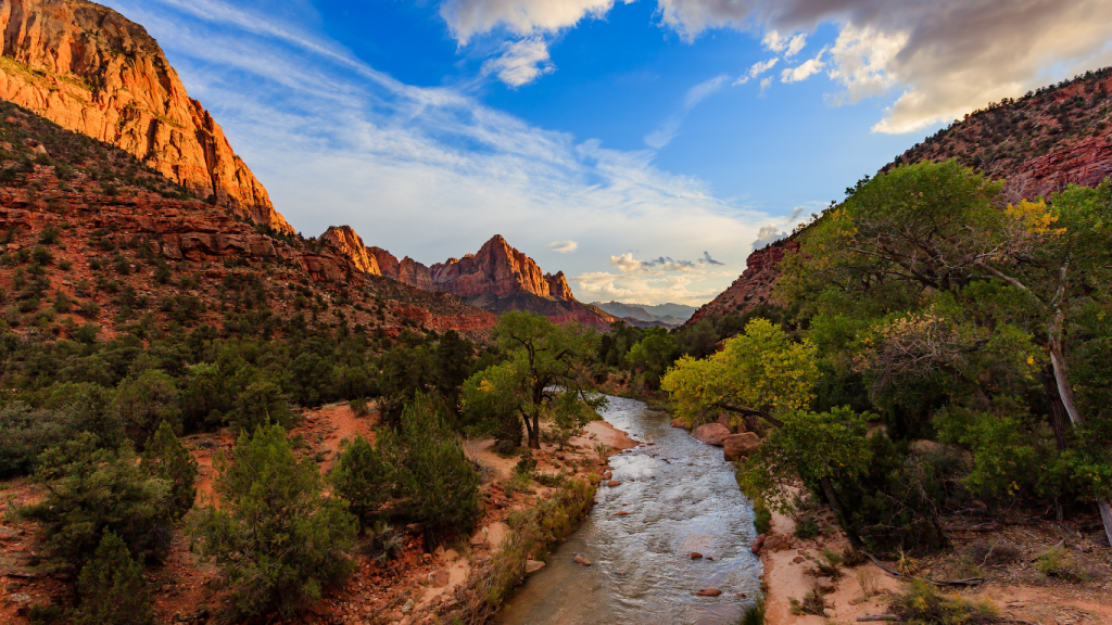
Zion National Park drops you right into the heart of the desert, with scenic drives, tunnels, and canyon views around every turn. There’s plenty to explore without venturing far off the main road.
- Distance from Calgary: 1,720 km (~17 hours)
- Distance to Las Vegas: 260 km (~2.5 hours)
Why it’s great
The park feels wild but is surprisingly accessible. Short trails, canyon overlooks, and scenic pullouts make it easy to stretch before the final drive to Vegas.
Practical tips
Arrive early if you want parking near the visitor center. EV chargers are available in nearby Springdale, and the shuttle system makes it easy to explore without moving your car.
How to get there
Follow I-15 south to UT-9 and enter through Springdale. It’s an excellent section for an electric vehicle like Chevrolet or Tesla. Chargers line the highway and local lodges.
Hoover Dam
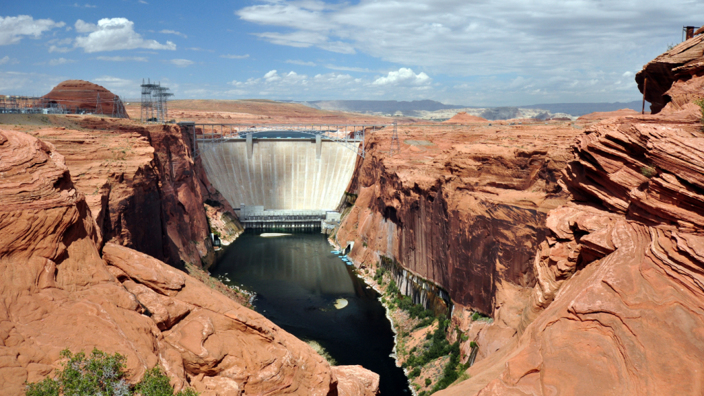
Just before you reach Las Vegas, Hoover Dam rises out of the desert—a massive engineering marvel connecting Nevada and Arizona. The views of Lake Mead stretch endlessly in both directions.
- Distance from Calgary: 1,880 km (~18.5 hours)
- Distance to Las Vegas: 55 km (~40 minutes)
Why it’s great
The contrast between massive concrete walls and open desert makes it one of the most dramatic landmarks on the drive. Even the overlook drive is unforgettable.
Practical tips
Expect security checks and limited parking near the viewing deck. Walkways are exposed, so bring water and a hat in summer.
How to get there
Take I-15 south, merge onto I-215, then US-93 toward Boulder City. To make the final stretch unforgettable, book a convertible, sports car, or classic car on Turo.
Frequently asked questions about the Calgary to Las Vegas road trip
Where is Las Vegas?
Las Vegas sits in Nevada’s Mojave Desert, surrounded by red rock canyons and rugged mountains. It’s 1,880 km south of Calgary by road.
Most travellers arrive through Harry Reid International Airport, just minutes from downtown. Booking your Calgary or Las Vegas airport car rental with Turo lets you pick up your vehicle right at the terminal.
How many hours from Alberta to Las Vegas?
The drive averages around 18 hours, depending on border wait times and stops. This route should not be attempted as a day trip from Calgary.
Is it cheaper to drive to Las Vegas or fly?
Flying is faster, but driving can be more affordable for families and groups. You save on airfare and get more flexibility and scenery.
What’s the fastest route between Calgary and Las Vegas?
Take Highway 2 south from Calgary to the Carway border crossing, then follow I-15 all the way through Montana, Idaho, Utah, and Nevada.
Are there scenic alternatives to I-15?
Yes. US-89 and UT-12 offer mountain and canyon views, fewer crowds, and incredible photo stops. They add time but reward you with unforgettable scenery.

Book your rental car in Calgary with Turo
It’s easy to enjoy a long drive when the car actually suits you. With Turo, you can skip the rental counter and choose a vehicle that matches exactly how you want to travel. Have it delivered to the airport, your hotel, or your driveway and get out on the open road!
Feeling inspired? Pitch a Trip and let Turo sponsor your vehicle rental to turn this adventure into a reality! Whether you’re a storyteller, photographer, or just love to travel, this could be your chance to share your experience with the world.