by Molly Isaac
posted on May 25, 2026
Scenic drives in Colorado wind through high alpine passes, historic mining towns, national parks, and red rock canyon country, where the landscape can shift from snow-capped peaks to desert cliffs in a single afternoon. Around nearly every bend is another dramatic overlook, winding mountain road, or small town that feels frozen in time.
With spectacular scenery stretching across both the Rockies and the high desert, Colorado is one of the great road trip states of the American West.
Scenic drives in Colorado: What you need to know
Colorado is home to 26 officially designated scenic and historic byways, plus countless mountain passes and back roads worth exploring. Conditions vary by season and elevation though, and many of the state’s highest roads aren’t open year-round. Here are a few useful insights:
- Best time to go: Summer (June–August) offers the widest access to Colorado’s mountain roads and high alpine passes. Fall (September–October) is many locals’ favorite time to drive, with golden aspen groves, cooler temperatures, and thinner crowds. Most high passes typically open around Memorial Day and close again by mid-October, depending on snowfall.
- Seasonal closures to know: Trail Ridge Road, Independence Pass, and several other high-elevation routes close during winter due to snow and dangerous driving conditions. Always check COtrip.org before heading out for the latest road conditions and closures.
- 4WD requirements: Most scenic drives featured in this guide are paved and suitable for standard 2WD vehicles and rentals on Turo. A small number of unpaved backroads and mountain routes are better suited to higher-clearance vehicles, especially after rain or late-season snow.
- Fees and reservations: Some routes — including Trail Ridge Road through Rocky Mountain National Park and the Pikes Peak Highway — require entry fees and timed-entry reservations during peak season. Booking ahead is recommended in summer and fall.
- Altitude awareness: Many of Colorado’s scenic drives climb above 11,000 feet. Take it slow, stay hydrated, and be prepared for fast-changing mountain weather — even in summer.

The best scenic drives in Colorado
Colorado’s scenic drives stretch right across the state, from soaring Rocky Mountain passes to red rock canyons and wide-open desert landscapes in the west. The routes below vary hugely in length, elevation, and driving difficulty.
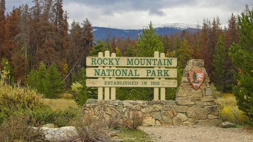
1. Trail Ridge Road, Rocky Mountain National Park
- Distance: 48 miles (Estes Park to Grand Lake)
- Drive time: 2–3 hours without stops; allow a full day
- Season: Late May through mid-October (weather dependent)
- Difficulty: Easy; paved, suitable for all vehicles
- Fee: Rocky Mountain National Park entry fee + timed entry reservations are often required during peak season
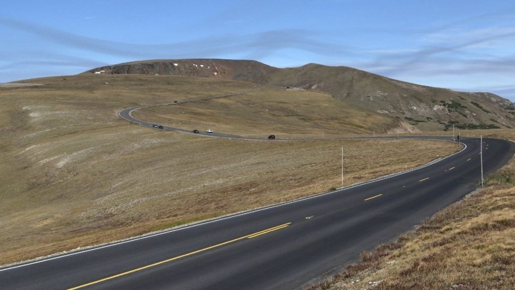
Standing at an impressive 12,183 feet, Trail Ridge Road is the highest continuous paved road in the US national park system — 11 miles are spent above the treeline surrounded by alpine tundra, towering peaks, and sweeping views across the Continental Divide.
The scenery shifts as you climb — dense pine forests and groves of aspen trees give way to wildflower-filled meadows before opening onto exposed rock, windswept tundra, and the rugged Never Summer Mountains in the distance.
Pull over at Many Parks Curve Overlook and Rainbow Curve, stop by the Alpine Visitor Center — the highest in the National Park Service system — and keep an eye out for roadside elk and bighorn sheep.
It’s worth mentioning that the drive is equally spectacular in either direction, if you’re traveling from Estes Park in the east to Grand Lake in the west.
The alpine landscape feels completely different depending on the weather and time of day, so no two drives here ever feel exactly the same.
Tip from the author: Leave Estes Park early to beat the crowds and catch the best morning light across the alpine tundra while wildlife is most active. Afternoon thunderstorms are common above the treeline in summer, so aim to be descending by early afternoon.
2. San Juan Skyway and the Million Dollar Highway
- Distance: 236 miles (full loop from Durango)
- Drive time: 7 hours driving; allow 2–3 days to explore properly
- Season: Year-round, though passes can close temporarily in winter
- Difficulty: Moderate — narrow lanes, steep switchbacks, and limited guardrails on some sections; not recommended for nervous drivers or those with a fear of heights
- Fee: Free (national park entry fees apply if visiting Mesa Verde)
The San Juan Skyway Loop drives through some of southern Colorado’s most stunning beauty — a 236-mile route winding through the rugged San Juan Mountains and linking towns including Durango, Silverton, Ouray, Telluride, and Cortez, with Mesa Verde National Park anchoring the southwest corner.
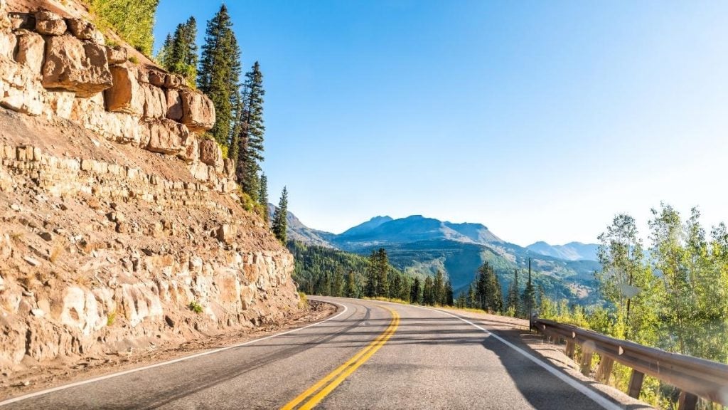
Its most legendary section is the Million Dollar Highway between Silverton and Ouray — a dramatic 25-mile stretch climbing over Red Mountain Pass at 11,075 feet, known for its tight switchbacks, sheer drop-offs, and “million dollar views.” The name either comes from the construction cost, or as local lore has it, from the gold ore hidden within the road fill itself.
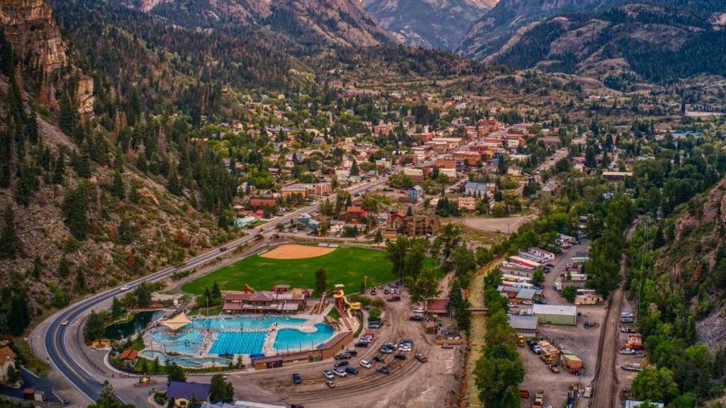
The towns along the route are part of what makes the drive unforgettable: Durango’s Old West railroad history, Silverton’s high-altitude Victorian mining streets, Ouray’s natural hot springs beneath towering cliffs, and Telluride’s world-famous ski slopes and summer festivals tucked into a striking box canyon.
It passes through five million acres of national forest shaped by Indigenous history, Spanish exploration, and Colorado’s gold and silver mining boom, with ghost towns still scattered through the San Juan Mountains.
Tip from the author: If you’re nervous about heights, drive the Million Dollar Highway north from Silverton to Ouray. The steep drop-offs sit on the passenger side instead of the driver’s side, which makes the experience feel slightly less intimidating.
3. Independence Pass and the Top of the Rockies Scenic Byway
- Distance: 130 miles (Aspen to Leadville, via Highway 82 and Highway 24)
- Drive time: 4–5 hours with stops
- Season: Independence Pass is open late May to late October; the broader byway is accessible year-round
- Difficulty: Moderate — Independence Pass section is narrow and winding with steep drop-offs; vehicles over 35 feet prohibited
- Fee: Free
Independence Pass is an unforgettable mountain drive, climbing to 12,095 feet as it crosses the Continental Divide on Colorado’s highest paved state highway.
The narrow, winding road twists through exposed alpine terrain with panoramic views, especially near the summit, where snow can linger well into summer.
As part of the Top of the Rockies Scenic Byway, the route connects Aspen with Leadville — the highest incorporated city in the US at 10,152 feet — while tracing the mining history of the Arkansas River Valley and passing Camp Hale National Monument, a former WWII winter training ground.
Part of what makes the drive so memorable is the constant shift in landscape: from Aspen’s green Roaring Fork Valley to the stark, windswept summits and the expansive Arkansas River Valley descending toward Leadville.
Its scenic beauty is the perfect alternative for travelers, combining Aspen with a scenic drive to or from Denver without taking the faster I-70 route.
4. Peak to Peak Scenic Byway
- Distance: 55 miles (Estes Park to Black Hawk/Central City)
- Drive time: 2–3 hours without stops
- Season: Year-round — the only high-elevation Colorado scenic byway open in winter
- Difficulty: Easy; well-maintained paved road
- Fee: Free (Rocky Mountain National Park entry fee if venturing into the park)
The Peak to Peak Scenic Byway is one of Colorado’s most accessible scenic drives — open year-round, easy to navigate, and consistently beautiful no matter the season.
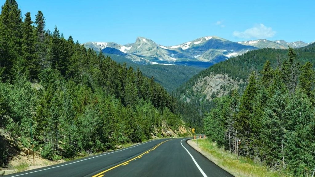
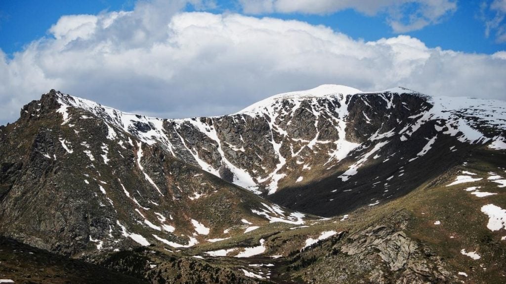
Set between Estes Park and Black Hawk, the route delivers expansive vistas of the Continental Divide and towering 14,000-foot peaks, including Longs Peak, while passing through mountain towns like Nederland and Allenspark along the way.
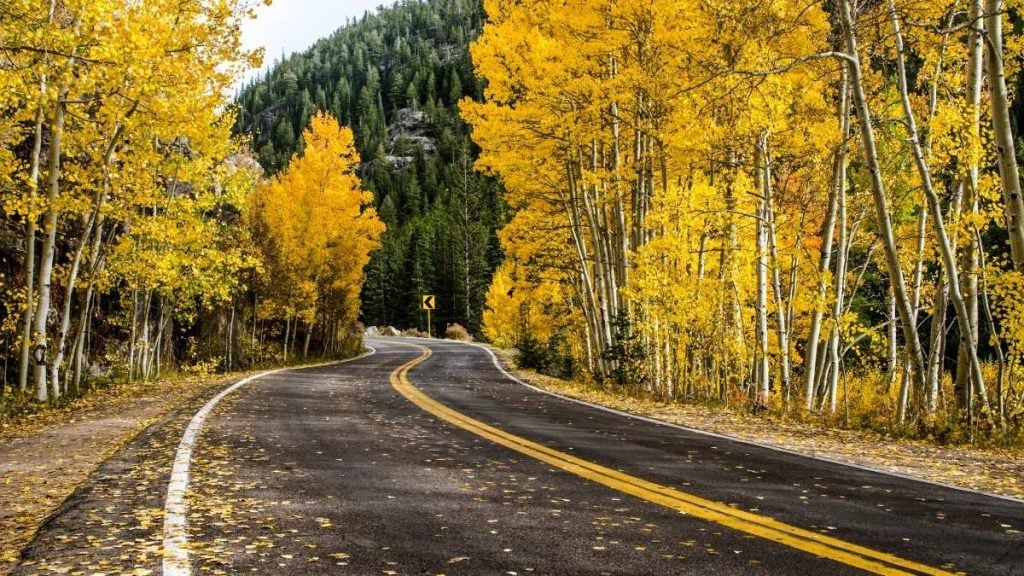
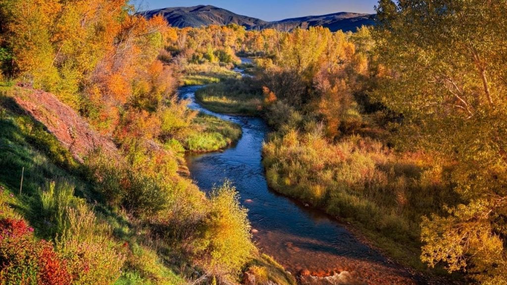
It’s especially popular in fall, when aspen forests turn brilliant shades of gold and orange.
For travelers already planning to drive Trail Ridge Road, the Peak to Peak Scenic Byway works perfectly as a gentler lead-in or final stretch, naturally connecting to Estes Park and the eastern side of Rocky Mountain National Park.
Tip from the author: Stop in Nederland for coffee before continuing north — it’s one of the byway’s most character-filled mountain towns. Near Estes Park, Lily Lake is also worth a quick stop for an easy walk with clear views of Longs Peak.
5. Colorado National Monument Rim Rock Drive
- Distance: 23 miles
- Drive time: 45 minutes–1.5 hours without stops; allow a half day
- Season: Year-round
- Difficulty: Easy; paved throughout
- Fee: National monument entry fee applies
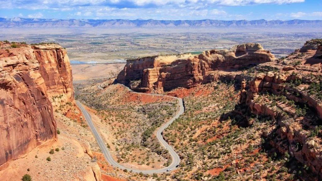
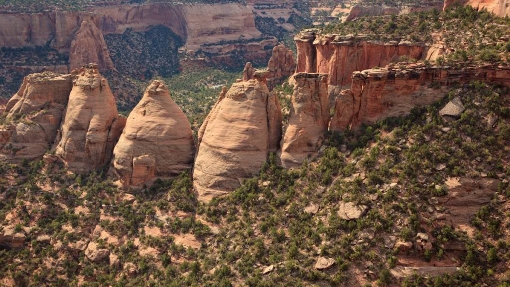
Rim Rock Drive through Colorado National Monument feels completely different from Colorado’s famous mountain passes — a dramatic canyon drive of towering red sandstone monoliths, sheer cliff walls, and wide-open desert views just outside Grand Junction.
Winding along the edge of deep rust-colored canyons, it’s Colorado’s great surprise — looking far more like southern Utah than the Rockies, especially in the warm light of sunrise or sunset. It becomes especially striking at sunrise and sunset when the red rock begins to glow.
Stop at Window Rock Overlook, Coke Ovens Overlook, and the Fruita Canyon viewpoints, where short walking trails branch off from the main road.
When Colorado’s higher passes are closed for the season, it’s an excellent year-round option. And perfect for travelers exploring western Colorado or combining the drive with time in Grand Junction.
Scenic drives near Denver
Denver makes an excellent base for scenic day drives, with several of Colorado’s most impressive mountain roads and canyon routes sitting within 1–2 hours of the city.
Mount Blue Sky Scenic Byway (formerly Mount Evans)
- Distance: 28 miles (Idaho Springs to summit)
- Drive time: 2–4 hours round trip
- Season: Memorial Day to Labor Day (weather dependent)
- Difficulty: Moderate — narrow switchbacks near the summit; vehicles over 30 feet not recommended
- Fee: Yes — purchase in advance
The Mount Blue Sky Scenic Byway is one of the easiest ways to reach truly high alpine scenery from Denver, with Idaho Springs sitting less than an hour from the city.
From there, the road climbs to the 14,264-foot summit of Mount Blue Sky, making it one of the highest paved roads in North America, offering stunning views stretching right across Colorado’s Front Range once you’re above the treeline.
Weekday mornings are easily the best time to drive it, offering quieter roads, fewer crowds, and calmer weather conditions near the summit.
Glenwood Canyon, I-70
- Distance: 12 miles
- Drive time: 15 minutes (though worth stopping)
- Season: Year-round (occasional closures for rockfall and weather)
- Difficulty: Easy — this is a section of I-70
Glenwood Canyon is a rare example of a truly beautiful drive that also happens to be a major interstate, tracing 12 miles of the Colorado River beneath colossal canyon walls of ancient Precambrian granite and rust-red sandstone. The road winds through a narrow river corridor where the cliffs rise almost vertically above the highway.
Pull off at the Hanging Lake trailhead — permits are required for the hike — or stop at one of the canyon rest areas to properly appreciate its scale.
It’s the kind of drive many Coloradans do routinely without fully realizing how extraordinary it is.
Peak to Peak Scenic Byway from Denver
For a scenic drive that’s easy to reach from Denver, the Peak to Peak Scenic Byway is hard to beat — see the full route details above. The southern end near Black Hawk sits around 45 minutes from the city, making it an easy half-day or full-day drive from the city.
Tips for driving scenic routes in Colorado
A little preparation goes a long way on Colorado’s mountain roads, so here are our insights:
- Check road conditions before you go: COtrip.org has live road cameras, closures, and weather updates for major routes across Colorado. Check it in the morning of your drive — conditions at altitude can change quickly, even in summer.
- Start early: Many of Colorado’s best scenic drives get noticeably busier by mid-morning during summer and fall. An early start usually means quieter roads, cooler temperatures, softer light, and a better chance of spotting wildlife.
- Watch the weather above the treeline: Afternoon thunderstorms are extremely common on Colorado’s high passes between June and August. On exposed roads like Trail Ridge Road and Independence Pass, it’s smart to aim to be below the treeline by early afternoon.
- Know your vehicle’s limits: Colorado’s mountain roads can be surprisingly demanding, with steep grades, tight switchbacks, and thin air affecting both engines and brakes. Use low gear on long descents, take your time on narrow stretches, and pull over safely if faster drivers begin stacking up behind you.
- Fuel up before remote stretches: Gas stations can be surprisingly sparse once you leave Colorado’s larger towns. On longer byways and mountain routes, it’s a good habit not to let your tank fall below half full.
- Respect posted speed limits: Many scenic byways have lower speed limits than drivers expect, particularly on mountain passes with blind corners and steep drop-offs. These roads are actively patrolled, and the slower pace is part of what makes the drives more enjoyable anyway.
- Carry water and layers: Colorado’s altitude catches a lot of visitors off guard. Even on warm summer days, temperatures above the treeline can change rapidly, so pack extra water, sunscreen, and at least one warm layer.
- Choose the right vehicle: Most drives in this guide are paved and manageable in a standard car, but extra power and ground clearance can make longer mountain routes feel far more comfortable. Browse vehicles on Turo to find something suited to Colorado’s steep grades, changing weather, and higher elevations.
Tip from the author: Don’t rely too heavily on drive times in Colorado’s mountains — a route that looks short on paper can easily turn into a full-day drive once you factor in overlooks, wildlife stops, weather, and slow-moving mountain traffic. The best drives here are the ones you leave room to experience properly.
Frequently asked questions about scenic drives in Colorado
What is the most scenic drive in Colorado?
The San Juan Skyway — particularly the Million Dollar Highway between Ouray and Silverton — is widely considered Colorado’s most spectacular scenic drive.
Trail Ridge Road through Rocky Mountain National Park is also one of the state’s most iconic drives and among the easiest high-alpine routes to access from Denver.
When is the best time to drive Colorado’s scenic byways?
Summer (June–August) offers the most access, with nearly all major passes open and long daylight hours.
Fall (September–October) is many locals’ favorite season thanks to cooler temperatures, golden aspen foliage, and fewer crowds.
Just remember that most high alpine passes close seasonally between late fall and late spring, depending on snowfall.
Do I need a 4WD to drive Colorado’s scenic routes?
No, you do not need a 4WD vehicle to drive Colorado’s scenic routes, as most Colorado byways are paved and suitable for standard 2WD vehicles. However, there are some rougher backcountry passes to look out for that are best avoided in standard cars.
Are Colorado’s scenic drives suitable for families?
Yes, many of Colorado’s scenic drives are very family-friendly, especially Trail Ridge Road, the Peak to Peak Scenic Byway, and Rim Rock Drive through Colorado National Monument.
The Million Dollar Highway section of the San Juan Skyway is much narrower and more exposed, though, so it may not suit nervous passengers or anyone prone to motion sickness.
Can I rent a car in Colorado to drive the scenic byways?
On Turo, it’s easy to find a vehicle suited to Colorado’s scenic byways, with options available across Denver, Colorado Springs, Grand Junction, and Durango.
Whether you want a comfortable SUV for mountain passes or a convertible for canyon-country drives, there is a wide range of vehicles available through Turo for every kind of road trip you could be planning. Explore available vehicles across Colorado here: Colorado car rental on Turo.
Explore Colorado by car
Colorado’s scenic drives reward anyone willing to slow down a little. From high alpine passes and red rock canyons to forested foothills and old mountain towns, the best parts of the state are often unexpected and found between the well-known major stops.
Whether you’re planning a weekend drive or a longer road trip, exploring by car gives you the freedom to explore Colorado on your terms. Find your perfect vehicle on Turo, and use this guide to plan your ideal trip.
Share your car, earn extra cash
Cover your car payments or earn some extra cash by sharing your car whenever you’re not using it.
Get startedHit the road
Browse thousands of cars for every occasion and budget near you, or wherever you’re going.
Browse cars
Molly Isaac
Molly Isaac is an experienced travel and automotive writer who loves the freedom of exploring new places in her own way and at her own pace. Her driving adventures have taken her through France and Italy, along Route 66, and across Australia, from its coastlines to the desert. She has a particular soft spot for Jeeps, preferably with the roof down, and for trips shaped by nature, spontaneity and a sense of adventure. For Turo, she writes practical, inspiring guides to scenic drives, family road trips and nature-filled escapes, helping travellers plan memorable journeys and choose a vehicle that feels right for the experience.