by Anna Hann
posted on 21 April 2025
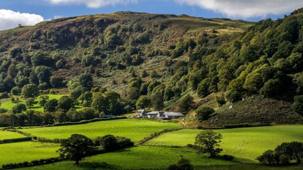
Wales is renowned for its scenic road trips that weave through its landscapes and rich cultural heritage. After all, there are three national parks and five areas of Outstanding Natural Beauty across this nation, offering incredible variety for road trippers.
Not sure where to start on choosing the best Wales road trip? Take a look at the Wales Way. It’s a collection of three scenic drives in Wales that showcase the nation’s landscapes, history, and culture. The three routes — the Coastal Way, the Cambrian Way, and the North Wales Way — cover different regions with distinct landscapes and points of interest. Decide whether you want to explore the entire length of the country, focus in on the castles of north wales or the beauty of South Wales, find the prettiest villages or remote spots free from hoardes of visitors, or if you want to search out Wales’ best beaches.
The most famous road trips on the Wales Way aren’t your only option. There are shorter scenic road trips, too. Whether you’re planning a full-length road trip or a quick scenic detour, Wales has a route for you.

The Wales Way: The Coastal Way
- Driving distance: Around 180 miles
- Duration: 1-3 days
- Highlights: Eryri views, Aberystwyth, New Quay, Pembrokeshire Coast, sandy beaches, seaside villages, and the chance to see dolphins and seals.
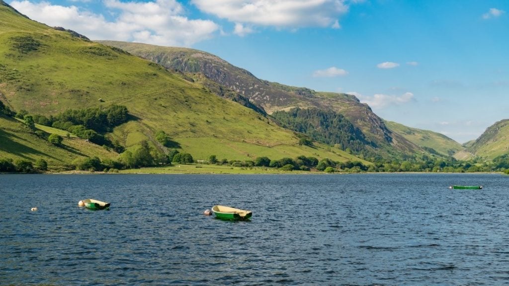
The Coastal Way runs along the west coast of Wales from Aberdaron on the Llŷn Peninsula to St Davids in Pembrokeshire. It follows the coastline of Cardigan Bay through small towns, fishing villages, and sections of two national parks. The route mainly follows the A487, with some minor roads leading to viewpoints and beaches.
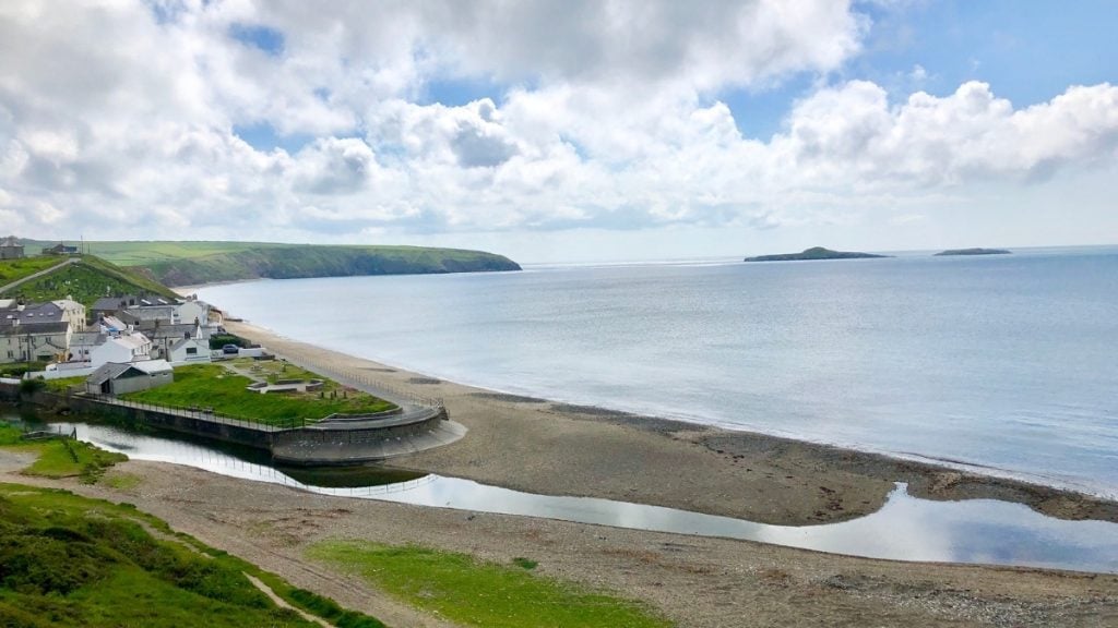
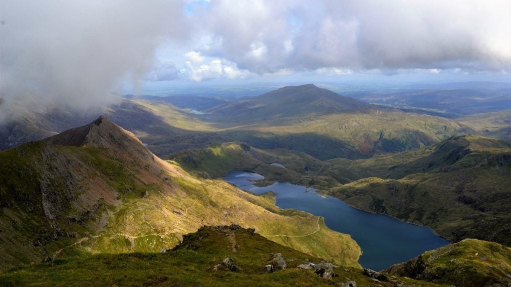
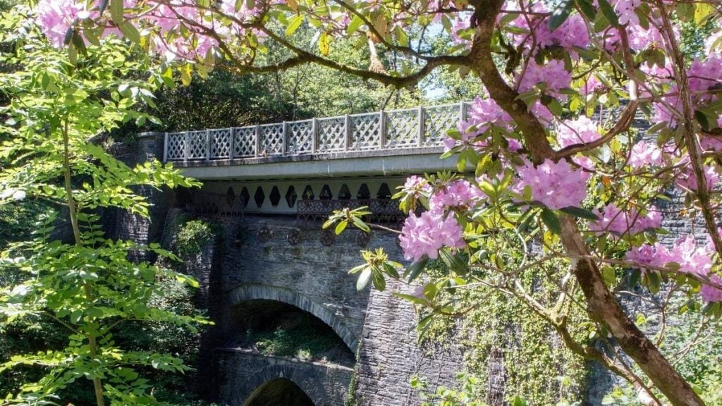
Start in Aberdaron in west Wales and take the route south along the Llŷn Peninsula, where you’ll catch views of the Irish Sea. Not too far into the journey, Pwllheli and Abersoch are popular stops on the Llŷn Peninsula, with pretty harbours and sandy beaches. The drive continues toward Porthmadog, where you can take detours to Eryri National Park (once known as Snowdonia National Park) and visit the Italian-style village of Portmeirion.
The section between Harlech and Barmouth is particularly scenic. Then, the road crosses the Mawddach Estuary south of Barmouth before reaching Aberystwyth, a university town with a seafront promenade. The stretch between Aberystwyth and New Quay closely follows the coast, and if you’re lucky, you might see dolphins leaping in Cardigan Bay.
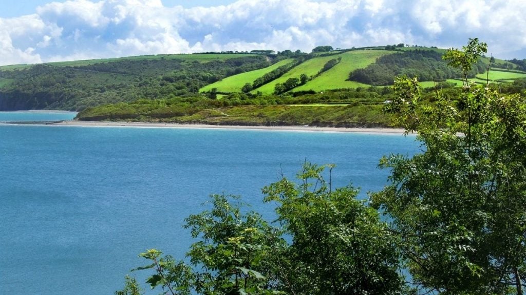
Beyond New Quay, the drive takes you through the market town of Cardigan before entering Pembrokeshire Coast National Park, where cliffs, coves, and beaches define the landscape.
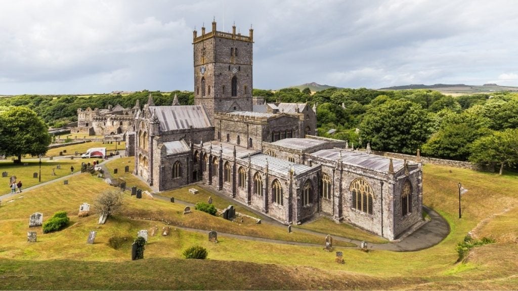
The final section toward St Davids includes some of the most dramatic scenery, particularly near Strumble Head and Whitesands Bay. St Davids, the smallest city in Britain, marks the end of the route, with its cathedral and access to the Pembrokeshire Coast Path.
The Wales Way: The Cambrian Way
- Driving distance: Around 185 miles
- Duration: 1-3 days
- Route highlights: Eryri, Cambrian Mountains, Elan Valley, Bannau Brycheiniog National Park, dramatic mountain landscapes, easy access to outdoor activities, and historical landmarks
The Cambrian Way runs from Llandudno in North Wales to Cardiff in South Wales, travelling through the mountainous centre of Wales on an almost complete north-south journey down the spine of Wales. You’ll mostly follow the A470, making it a straightforward drive while allowing for detours to visit more remote areas.
The route starts in Llandudno on the north coast of Wales before heading inland toward Betws-y-Coed, a gateway to Eryri, Snowdonia National Park. The section between Betws-y-Coed and Dolgellau is particularly scenic, a mountain road with views of forested valleys, rivers, and the peaks of Yr Wyddfa. South of Dolgellau, the road takes you through the Dyfi Biosphere, which is recognised for its natural beauty and diverse wildlife.
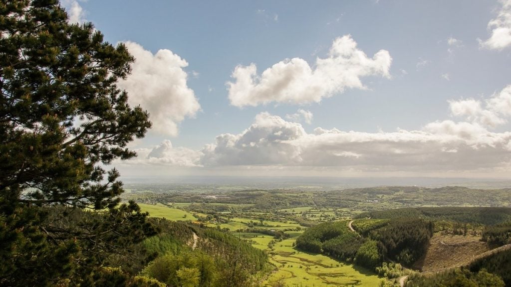
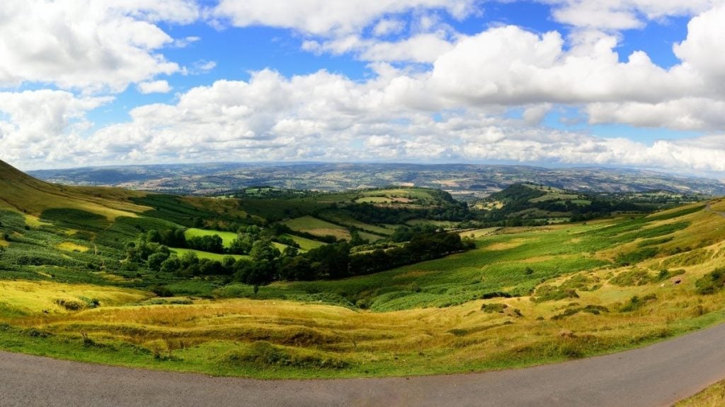
The stretch between Machynlleth and Rhayader takes you through the Cambrian Mountains, a remote and sparsely populated area with empty moorland and winding roads.
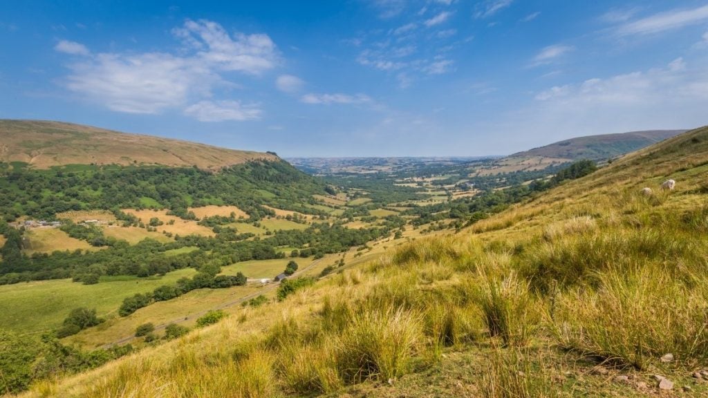
Further south, the route reaches the Elan Valley and the Brecon Beacons (or Bannau Brycheiniog, to give it its proper Welsh name), where the landscape changes to rolling hills and high peaks. The section between Brecon and Merthyr Tydfil includes views of Pen y Fan, the highest peak in southern Britain. As the drive nears Cardiff, the route descends through the valleys, marking the transition from rural Wales to the Welsh capital.

The Cambrian Way can be completed in a day, but you could easily spend much longer on this trip, allowing you far more opportunity to stop at scenic viewpoints and historic towns and try some of the walking trails.
The Wales Way: The North Wales Way
- Driving distance: Around 75 miles
- Duration: 1 day
- Route highlights: Llandudno, castles, Yr Wyddfa views, Conwy, Menai Strait, Anglesey
The North Wales Way follows an old trade route along the northern coast of Wales, running from the English border near Chester to the island of Anglesey. The North Wales Way can be driven in a day, but taking extra time allows you to explore the castles that reveal chapters of Welsh history, walk the coastal paths, and spend longer admiring the stunning scenery of this captivating part of the British Isles.
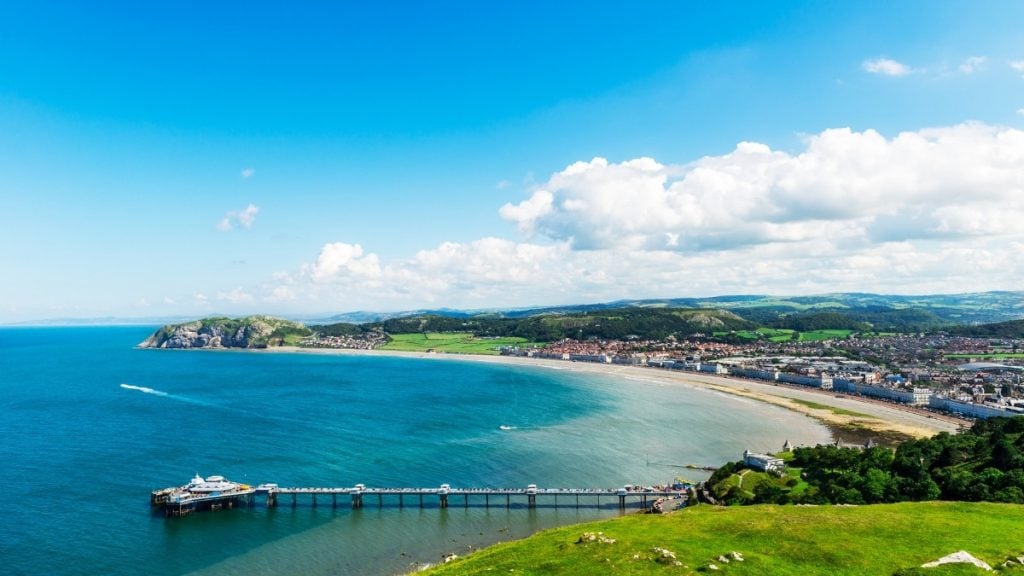
Starting near Chester, the route heads west through Flintshire. Stop at the ruins of Flint Castle, a medieval fortress with views over the Dee Estuary, then continue along the A55 through Colwyn Bay. You’ll reach the seaside town of Llandudno, known for its wide promenade and the Great Orme, a limestone headland with a scenic toll road offering views over the Irish Sea.
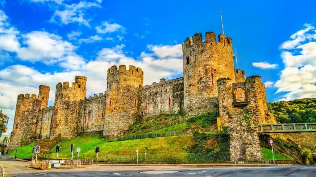
The section from Llandudno to Conwy is particularly picturesque, with the walled town of Conwy and its castle, which, together with three other Welsh castles, is part of a UNESCO World Heritage Site.
Beyond Conwy and its castle, the road follows the coast through Penmaenmawr and Llanfairfechan, where there are viewpoints overlooking the sea. As the route nears Bangor, you’ll cross the Menai Strait into Anglesey.
Clwydian Range and Dee Valley
- Driving distance: Around 35 miles
- Duration: Half-day to 1 day
- Route highlights: Llangollen, Pontcysyllte Aqueduct, scenic mountains, and heritage sites
This short road trip starts in Mold and finishes in Llangollen, taking in a scenic area of northeast Wales. The route takes you through the Clwydian Range, an Area of Outstanding Natural Beauty, with stops at Moel Famau Country Park and Loggerheads Country Park.
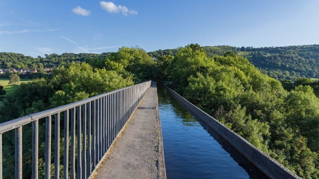
The drive continues to Ruthin, a historic market town, before heading through the Horseshoe Pass, which offers panoramic views. It then descends into Llangollen, known for its canal, steam railway, and the UNESCO World Heritage Site, Pontcysyllte Aqueduct and Canal — well worth a visit.
The Abergwesyn Pass
- Driving distance: Around 20 miles
- Duration: 1-2 hours
- Route highlights: Remote mountain landscapes, Devil’s Staircase, dramatic mountain scenery
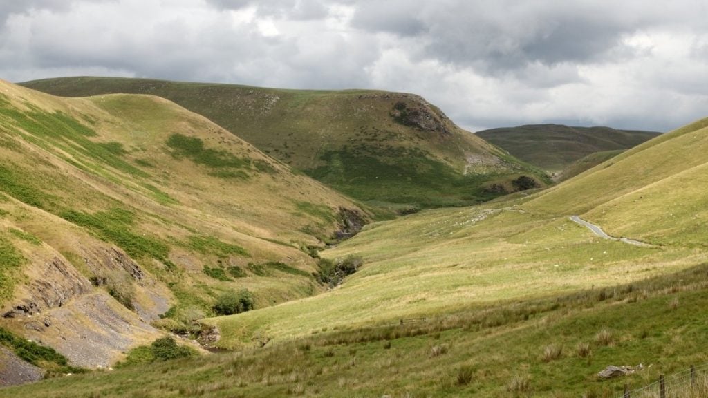
The Abergwesyn Pass is a remote and challenging drive through the Cambrian Mountains in mid-Wales, covering around 20 miles between Llanwrtyd Wells and Tregaron, cutting through the Nant Irfon Nature Reserve in Powys.
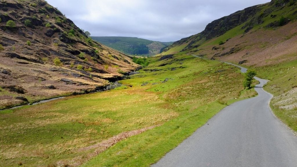
The route features steep inclines, hairpin bends, and open moorland, offering incredible views of rugged landscapes and forested valleys. The Abergwesyn Pass features a hairpin turn known as the ‘Devil’s Staircase’ with a steep 25° incline, a highlight of the journey. With few settlements along the way, the road feels thrillingly remote, a true escape into the wild heart of Wales.
The Gospel Pass
- Driving distance: Around 22 miles
- Duration: 1-2 hours
- Route highlights: Highest road in Wales, Black Mountains, Bannau Brycheiniog views, historic ruins, great for scenic photography
The Gospel Pass is the highest road in Wales, reaching 1,801 feet and running for about 22 miles between Hay-on-Wye and Llanthony in the Black Mountains. The narrow, winding route offers expansive views over the Wye Valley and the Bannau Brycheiniog, or Brecon Beacons National Park.
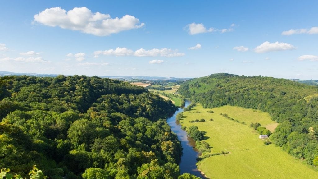
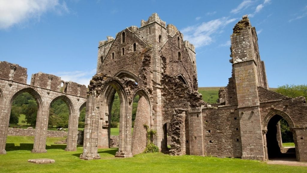
The ascent from Hay-on-Wye is through open moorland, while the descent into Llanthony features steep sections and stone-walled lanes. A highlight along the way is Llanthony Priory, a historic ruin set in a remote valley. The road is single-track in places with passing points and can be challenging in poor weather.
The Talyllyn Pass
- Driving distance: Around 7 miles
- Duration: 30-45 minutes
- Route highlights: Rugged valleys, Talyllyn Railway, mountain vistas, historical railway
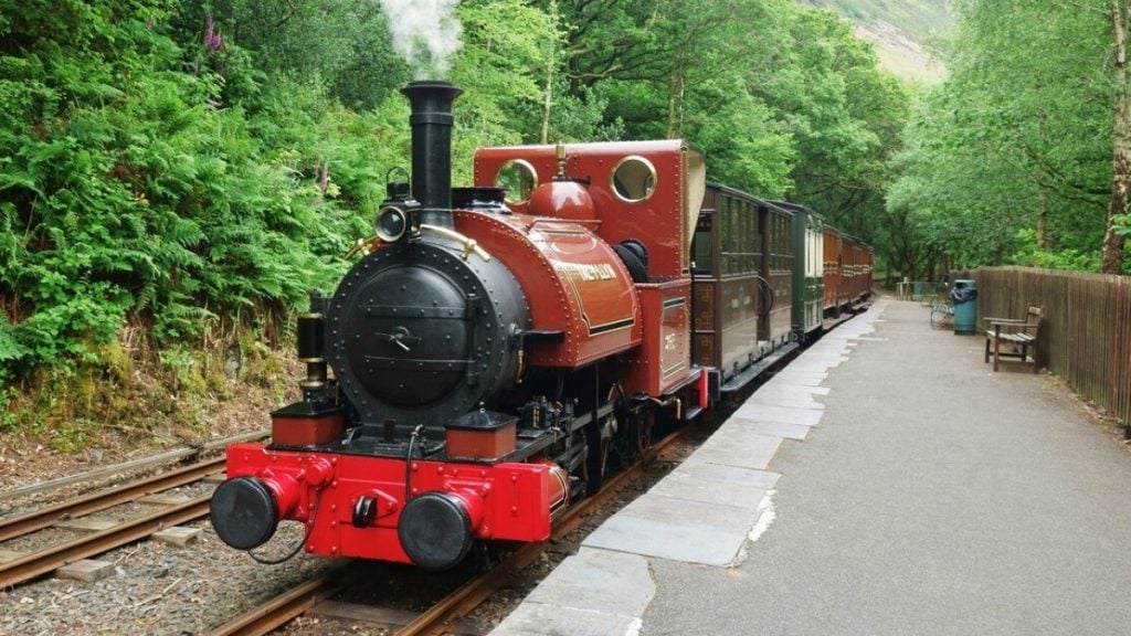
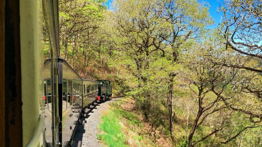
The Talyllyn Pass is a scenic, winding mountain road in southern Eryri, Wales, stretching about 7 miles between Abergynolwyn and Dolgellau.
The mountain pass cuts through dramatic landscapes of steep valleys, rugged slopes, and forested areas. It offers breathtaking views of the surrounding mountains and the Talyllyn Railway, a historic narrow-gauge steam railway that runs parallel to part of the route. The pass is narrow and twisting, with steep gradients, so careful driving is necessary, ideally in a suitable car that can make light work of these driving roads.
The Ystwyth Valley
- Driving distance: Around 14 miles
- Duration: 1 hour
- Route highlights: Lush countryside, waterfalls, peaceful valley, historical sites, Vale of Rheidol Railway
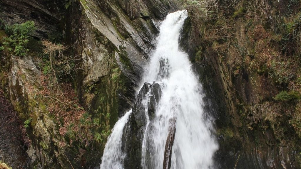
The Ystwyth Valley drive is a picturesque route through central Wales, following the A4120 from Aberystwyth to Devil’s Bridge.
The 14-mile journey takes you through lush countryside, dense woodlands, and alongside the winding Ystwyth River. The valley is known for its dramatic scenery, steep hillsides, historic stone bridges, and seclusion. Along the route, you can explore the small village of Devil’s Bridge, home to the famous triple waterfall and the Vale of Rheidol Railway. The narrow, winding road offers a peaceful escape, though you should be cautious on tight bends and uneven surfaces.
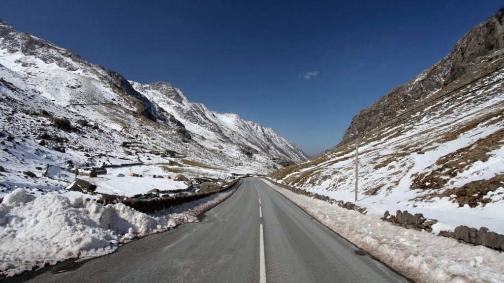
The Llanberis Pass
- Driving distance: Around 5 miles
- Duration: 30-45 minutes
- Route highlights: Yr Wyddfa views, lakes, rugged terrain, access to hiking routes
This dramatic short drive in North Wales stretches only 5 miles between Llanberis and Capel Curig. It winds through the heart of Eryri National Park, offering spectacular views of rugged peaks, including Yr Wyddfa, the highest mountain in Wales. It’s narrow and often steep, with sharp bends, so careful driving is necessary.
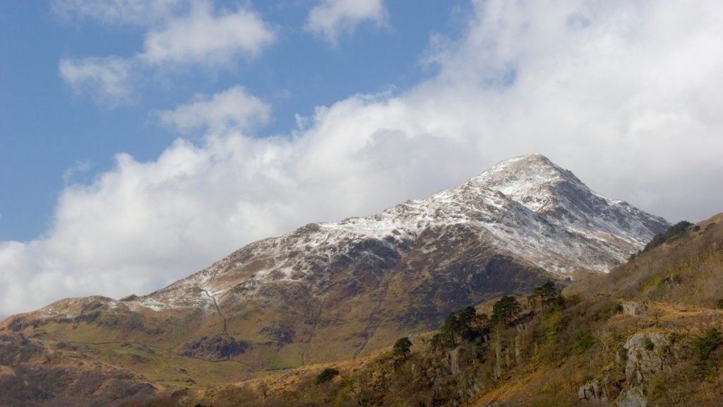
You’ll pass lakes, waterfalls, and rocky terrain, creating a striking and atmospheric setting. Popular with hikers and climbers, the Llanberis Pass provides access to the start of several mountain trails, including the Llanberis Path up Yr Wyddfa.
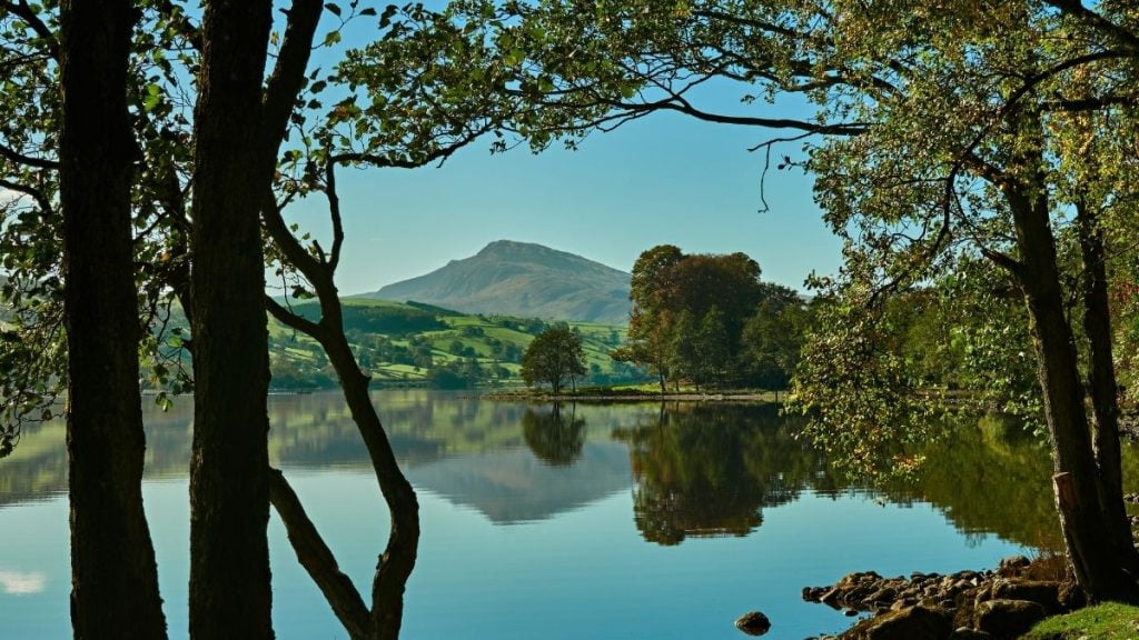
The Bala Loop
- Driving distance: Around 12 miles
- Duration: 30-45 minutes
- Route highlights: Lake views, Welsh countryside
The Bala Loop is a stunning circular drive beginning and ending in Bala around Llyn Tegid, Wales’ largest natural lake in Eryri. It winds through the southern edges of Eryri, offering dramatic landscapes, serene lakesides, and glimpses of traditional Welsh countryside.
The best cars for driving in Wales
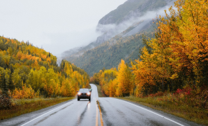
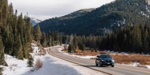
When renting a car to drive in Wales, consider features that enhance safety and performance on narrow, winding, and often hilly roads. All-wheel drive or good traction control is valuable for rural and mountainous terrain, especially in wet or snowy weather. For example, navigating the Devil’s Staircase on the Abergwesyn Pass is far easier in a compact SUV with solid traction control — and a little nerve.
Good headlights and fog lights improve visibility in low-light or misty conditions common in Welsh valleys. While a powerful SUV might be a good option, there’s something to be said for choosing a more compact vehicle that may be easier to navigate the tight country lanes.
GPS with offline maps and clear road sign recognition is helpful, given some areas may have weak mobile signal or signage in Welsh.


Take control of your financial future and start building your car sharing business on Turo!
Get started
Browse thousands of cars for every occasion and budget near you, or wherever you’re going.
Browse cars