posted on October 2, 2026
Are you looking for an epic driving route that covers picturesque valleys, deserts, and alpine lakes in Southern California? Nature lovers: don’t miss the chance to experience the thrilling Rim of the World scenic drive.
From hairpin turns to high-elevation panoramic views, this one-day driving route is ideal for travelers wanting to get off the beaten path. Venture along the cliffs of the San Bernardino Mountains and complete the entire drive within a few hours (leaving time to grab some spectacular scenic photos along the way, of course!).
In this guide, we’ll be covering:
- An overview of the drive
- Your road trip map along the Rim of the World
- Top tips for driving the Rim of the World
- Your stop-by-stop Rim of the World drive itinerary
- Top places to stop along the Rim of the World
- Frequently asked questions about the Rim of the World scenic drive

An overview of the drive
- Drive time: ~2-3 hours (direct route, not including stops)
- Drive distance: ~110 miles (via SR-138, SR-18, SR-38)
- Suggested road trip length: A half-day to full-day trip; a weekend if combining with a Big Bear or Lake Arrowhead stay
- Recommended itinerary:
- Stop 1: Cajon Pass to Crestline
- Stop 2: Crestline to Lake Arrowhead
- Stop 3: Lake Arrowhead to Running Springs
- Stop 4: Running Springs to Big Bear Lake
- Stop 5: Big Bear Lake to Mill Creek Canyon
- Top stops: Big Bear Lake, Lake Arrowhead Village, scenic overlooks along SR-18
- Gas stations along the drive: available in Crestline, Lake Arrowhead, Running Springs, and Big Bear; fuel up before tackling the more remote stretches.
- Driving conditions and recommended vehicle: Expect winding mountain roads with steep drop-offs in places; a comfortable, easy-handling car matters more than size.
Ready to explore some of the most naturally beautiful areas in Southern California? The Rim of the World Scenic Byway runs along the crest of the San Bernardino Mountains, offering stunning panoramic views across the San Bernardino valley and beyond.
While you can drive the entire route in 2-3 hours, set aside a full day to stop at the scenic viewpoints and alpine towns along the way. If you’re planning to hike or picnic in the San Bernardino National Forest, make sure to secure a National Forest Adventure Pass or an America the Beautiful Interagency Pass (available from local ranger stations, major sporting goods stores, or online).
Distance for the Rim of the World scenic drive
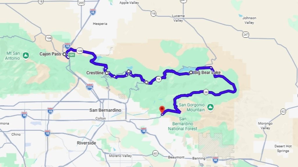
The Rim of the World scenic drive runs for approximately 107 miles (172 km), covering multiple roads (including California State Route 138, California State Route 18, and California State Route 38). The drive starts in Cajon Pass and ends in the east at the San Gorgonio Pass / Mill Creek Area.
Rim of the World drive time
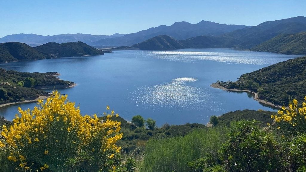
The drive time on the Rim of the World Scenic Byway is typically 2-3 hours direct in normal conditions. However, this winding mountain route features tight, clifftop switchbacks and steep climbs (reaching elevations over 7,000 feet). As a result, most drivers take around 5-6 hours to complete the drive, including plenty of stops at vantage points like Silverwood Lake Overlook.
Keep in mind that this byway can experience bottlenecks and heavy traffic on Fridays and Sundays as travelers head to Lake Arrowhead and Big Bear Lake during ski and peak summer season.
When to go on the Rim of the World scenic drive
Fall (October to November) and late spring (May) are the best times to drive along the Rim of the World Scenic Byway. Both shoulder seasons offer steady driving conditions, pleasant weather, and fewer crowds. Fall brings stunning foliage and crisp air, while spring offers lush mountain terrain and flowing waterfalls.
Tip from the author: While the Rim of the World scenic drive is open year-round, you’ll need extra planning if you’re visiting in winter. Tire chains are mandatory and the roads can be challenging and even dangerous for inexperienced mountain drivers. Expect unpredictable temperatures, thick fog, and even dangerous black ice. Check conditions before you depart, monitor the forecast, and drive defensively on the roads.
The best Rim of the World route
Most drivers tackle the Rim of the World scenic drive from west to east, starting in Cajon Pass (a mountain pass between the San Gabriel and San Bernardino Mountains) before heading east to Big Bear Lake. Expect a cliff-hugging route that takes you through stops like Lake Arrowhead and Running Springs.
Alternatively, you can reverse the route (travel from east to west) or add a southern descent via State Route 38, which snakes down Mill Creek Canyon into Redlands and then across to San Bernardino or Cajon Pass. The reverse route works well for scenic pull-offs, as you’ll be easily able to turn right into viewing areas without worry about crossing oncoming mountain traffic.
The best stop on the Rim of the World scenic drive
Running Springs marks the halfway point of the Rim of the World scenic drive, sitting between Crestline and Big Bear Lake. It’s an ideal spot for a photo, a short stroll, or a bite to eat. Wanting to take a longer break? Stop at Lake Arrowhead Village for a waterfront stroll or a bite to eat (Belgian Waffle Works offers lake views and plenty of sweet and savory options).
Your road trip map along the Rim of the World
Top tips for driving the Rim of the World Scenic Byway
Don’t let the dramatic cliffs and panoramic views distract you along the Rim of the World Scenic Byway. This mountain route features plenty of tight curves, blind corners, and unpredictable weather, so take it slow, drive cautiously, and take frequent breaks.
Locals know this road well, and commuters and delivery drivers often move fast through the curves. If someone’s riding your bumper, don’t speed up to match them; just use one of the turnouts along SR-18 to let them pass safely.
Driving conditions: what is the Rim of the World like to drive?
- Mountain driving: Narrow, winding mountain road with steep drop-offs in sections; not recommended for drivers uncomfortable with heights or switchbacks. Elevations along the route top 8,000 feet in places.
- Winter tires and chains: Freezing winter conditions can bring snow and ice; tire chains may be required in storms so check current Caltrans conditions before you leave.
- Viewpoints: Frequent turnouts along SR-18 for photos and views; use them rather than stopping in the road, and watch for oncoming traffic when crossing lanes to pull in or out, since some of the best viewpoints sit on the opposite side of the road from where you’re driving
- Visibility and debris on the road: Fog is possible at higher elevations, reducing visibility. Plus, because the highway hugs the cliffside, rockslide debris, loose gravel, or small stones can end up on the road, especially after rain or wind; keep a safe following distance so you have time to react.
Recommended type of car for the Rim of the World drive
Comfortable handling matters more than size on a road like this. A smaller car or a compact SUV will feel more at home on the tight switchbacks than anything oversized or hard to maneuver. If you’re driving in winter, a vehicle with AWD can offer extra traction on snowy roads, though it’s still worth checking conditions and carrying chains when storms are forecast. Whatever you choose, make sure the brakes are in good shape; you’ll want them for the long descents.
Browse Turo for car rentals in San Bernardino and find the right vehicle for this scenic drive.
How to stay safe on this road trip
- Use turnouts for photos, and never stop in the traffic lane
- If a car is tailgating you, don’t speed up; pull into a paved turnout and let it pass rather than feeling pressured to match its pace
- On long downhill stretches, like the descent toward Lucerne Valley or down State Route 330, shift into a lower gear instead of riding the brakes, which can overheat and lose effectiveness on a grade like this
- Check current road and chain conditions before you head out, especially between late fall and early spring; mountain weather can turn quickly
- Keep headlights on given the potential for fog at higher elevations
- Watch for cyclists, who use this route regularly
- Keep your eyes on the lane, not the view; the drop-offs can be disorienting for drivers sensitive to heights, so save the sightseeing for when you’re a passenger or stopped at a turnout
The perfect Rim of the World drive itinerary
Ready to hit the road? This scenic route offers sweeping views of valleys, forest, and alpine lakes, making the Rim of the World Scenic Byway a bucket-list drive for anyone visiting California.
Stop 1: Crestline
- Drive time: ~25 minutes from the Cajon Pass start of the byway
- Drive distance: ~13 miles
- What to do: Small mountain town feel, first stop after climbing out of the valley; shops and restaurants
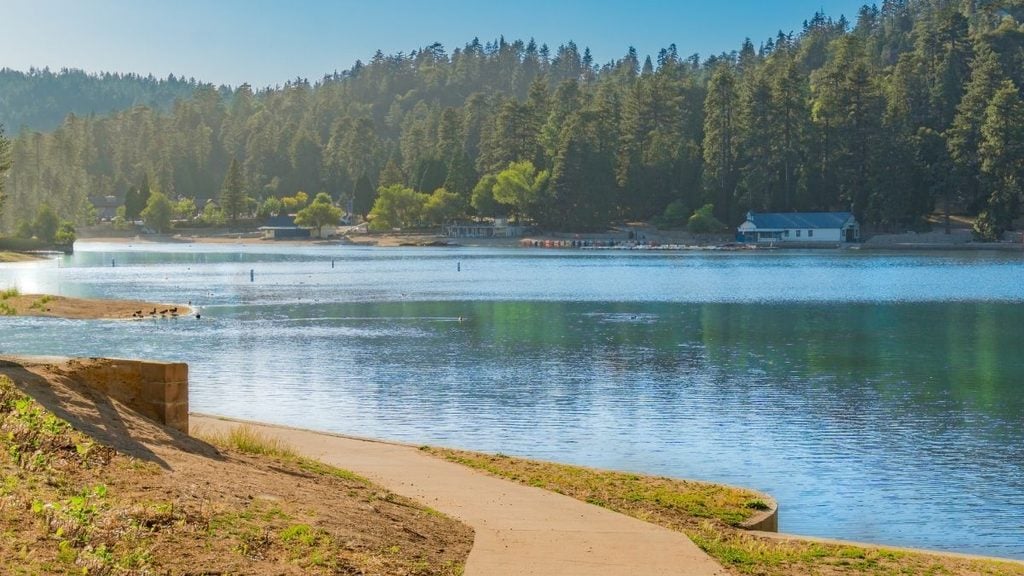
As the first official place to stop on the drive, pulling over at the laid-back mountain town of Crestline is worthwhile. Stretch your legs at Lake Gregory Regional Park (there’s an easy, flat walking trail that loops around the lake) or head to Stroll Lake Drive for vintage stores, thrift shops, and mountain boutiques. Grab a bite at Stockade Grub & Whiskey; it’s a cozy cabin eatery that sets the tone for the drive ahead.
Stop 2: Lake Arrowhead
- Drive time: ~15 minutes from Crestline
- Drive distance: ~8 miles
- What to do: Lake Arrowhead Village for dining/shopping, lake views
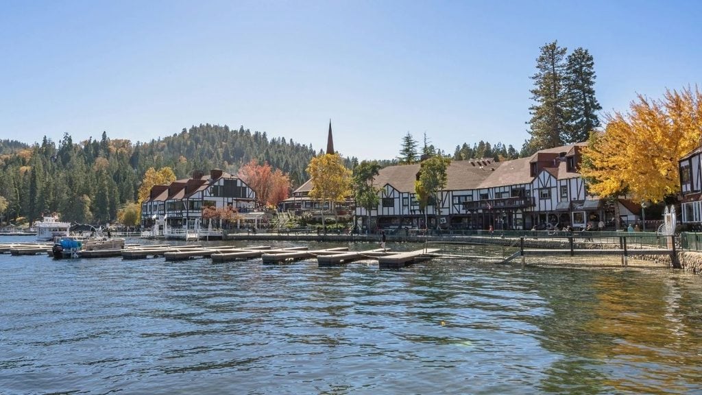
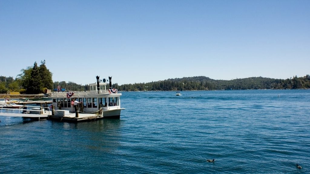
While Lake Arrowhead itself is private, the village and surrounding overlooks are open to the public. If you have time to spare, consider a 1-hour tour on the historic Arrowhead Queen paddleboat or stroll along the waterfront boardwalk (packed with over 50+ stores and plenty of cozy cafes to explore).
Stop 3: Running Springs
- Drive time: ~15 minutes from Lake Arrowhead
- Drive distance: ~9 miles
- What to do: Smaller mountain community, good rest stop, access point for surrounding forest trails
By now, you’ve reached the heart of this mountain drive. Expect a more rugged mountain gateway town, with a handful of spots to grab a bite (Old Town Baking Company does great cinnamon rolls, or head to Jensen’s Finest Foods for road trip snacks). Stretch your legs with a visit to Keller Peak Fire Lookout; the peak reaches nearly 8,000 feet and gives you the chance to visit a fully operational historic fire lookout tower.
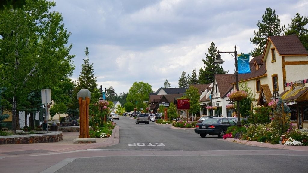
Stop 4: Big Bear Lake
- Drive time: ~30 minutes from Running Springs
- Drive distance: ~20 miles
- What to do: Hiking trails, lake activities, seasonal bald eagle viewings in winter; the largest destination on the route
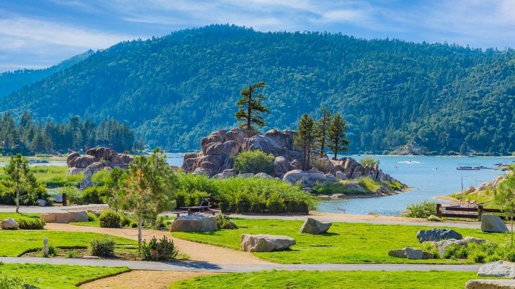
This pristine alpine basin offers towering pine forests, dramatic mountain peaks, and a world-class resort. In winter, expect some of the region’s best skiing and snowboarding while summer brings an incredible downhill mountain biking park.
Relax at Boulder Bay Park, take a stroll through Big Bear Village (it’s a pedestrian-friendly area with fire pits, shops, and tasting rooms), or hit the Alpine Slide at Magic Mountain (a bobsled-style track down the mountain). Once you’ve worked up an appetite, head to Grizzly Manor Cafe (an old-school mountain diner), The Pines Lakeside Dining, or Big Bear Lake Brewing Company for craft beers brewed on-site. Make sure you have a designated driver if you’ll be sampling.
Stop 5: Mill Creek Canyon
- Drive time: ~30 minutes from Big Bear Lake
- Drive distance: ~20 miles
- What to do: Trip endpoint near the San Bernardino National Forest boundary; views of the Sand to Snow National Monument along this stretch
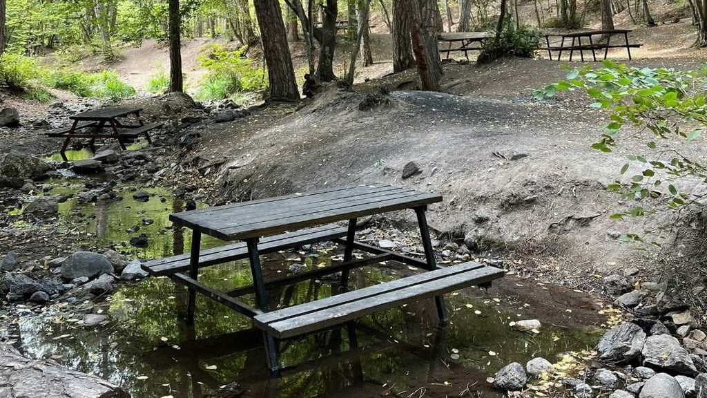
To round out this drive, you’ll end at Mill Creek Canyon. Consider a detour to California’s tallest waterfall (Big Falls), enjoy a picnic at Thurman Flats Picnic Area, or soak in the valley views as the landscape shifts from desert to thick pine and cedar forests.
Looking for other epic spots to explore? Discover the best day trips from Los Angeles.
Top places to stop along the Rim of the World
No matter what brings you to Southern California, there’s something for every kind of traveler on the Rim of the World Scenic Byway.
Top stops for nature lovers
- Big Bear Lake: For hiking trails, watersports, and mountain views
- Scenic overlooks along SR-18: Pull off for sweeping views back down over the valley
- Sand to Snow National Monument viewpoints (near Mill Creek): Expect high-elevation views over the desert floor below
- San Bernardino National Forest trails near Crestline: Enjoy shorter, easy-access hikes right off the highway
Top stops for foodies
- Teddy Bear Restaurant, Big Bear Lake: A log-cabin diner serving hearty American classics since the 1940s
- Grizzly Manor Cafe, Big Bear Lake: A longtime local breakfast spot known for oversized pancakes (but get in early as there are just 25 seats!)
- Lake Arrowhead Village dining: Enjoy lakeside restaurants and casual eateries with water views
Top stops for families
- Alpine Slide at Magic Mountain, Big Bear Lake: Toboggan slide, go-karts, and mini golf
- Big Bear Alpine Zoo: A wildlife sanctuary, easy add-on stop for families with kids
- SkyPark at Santa’s Village: This nostalgic theme park delivers Christmas magic all year long, with outdoor roller skating, rock climbing, and ziplining
Frequently asked questions about the Rim of the World scenic drive
How long is the Rim of the World scenic drive?
The direct Rim of the World drive takes about 2–3 hours, covering roughly 107 miles along SR-138, SR-18, and SR-38. Most drivers spend closer to 5–6 hours once you factor in stops at scenic overlooks and mountain towns like Lake Arrowhead and Big Bear Lake.
Is the Rim of the World scenic drive worth it?
Yes, the Rim of the World is one of the most scenic drives in Southern California, with sweeping mountain views, alpine lakes, and forest scenery you won’t find on the valley floor. Just be prepared for winding roads and steep drop-offs, so it’s best suited to confident mountain drivers.
Do I need chains to drive the Rim of the World in winter?
Tire chains can be required on the Rim of the World scenic drive during winter storms, especially at higher elevations. Always check current Caltrans road conditions before you set out, and carry chains in your trunk between late fall and early spring just in case.
Can you see bald eagles on the Rim of the World drive?
Yes; Big Bear Lake is a popular winter viewing spot for bald eagles, with sightings typically from late November through March. Local eagle-watching programs run around the lake during this season for the best chance of spotting one.
What is the best time of year to drive the Rim of the World?
Fall (October to November) and late spring (May) offer the most reliable driving conditions, with mild weather and lighter crowds on the Rim of the World scenic drive. Fall brings vivid foliage, while spring means green mountain terrain and flowing waterfalls after the snowmelt.
Planning the Rim of the World drive of a lifetime
Whether you’re chasing sweeping valley views, alpine lake towns, or a thrilling mountain road trip, the Rim of the World Scenic Byway delivers all three in a single day. Take your time at the overlooks, factor in a stop in Lake Arrowhead or Big Bear Lake, and you’ll come away with one of the best scenic drives Southern California has to offer.
Ready to get moving? With Turo, booking the perfect rental car in San Bernardino is easy. Choose from a wide range of vehicles to suit every itinerary, whether you need something compact and easy to handle on the switchbacks or a bit more room for the whole family to be comfortable.

Share your car, earn extra cash
Cover your car payments or earn some extra cash by sharing your car whenever you’re not using it.
Get startedHit the road
Browse thousands of cars for every occasion and budget near you, or wherever you’re going.
Browse cars
Lucinda Starr
Lucinda Starr is a travel and automotive writer with 5+ years of firsthand experience road-tripping across Australia, New Zealand, and beyond. She writes road trip guides for Turo, drawing on her experience behind the wheel to share practical insights on long-distance drives, destinations, and vehicles. Her travels have taken her across Australia’s East Coast, Victoria’s Great Ocean Road, the Northern Rivers, Byron Bay, and both islands of New Zealand. One of her most memorable journeys was an 11-day, 2,600+ km route from Auckland to Punakaiki and Queenstown. Lucinda has a particular passion for classic, rugged 4WD vehicles and the freedom they bring to exploring new places.