posted on July 16, 2026
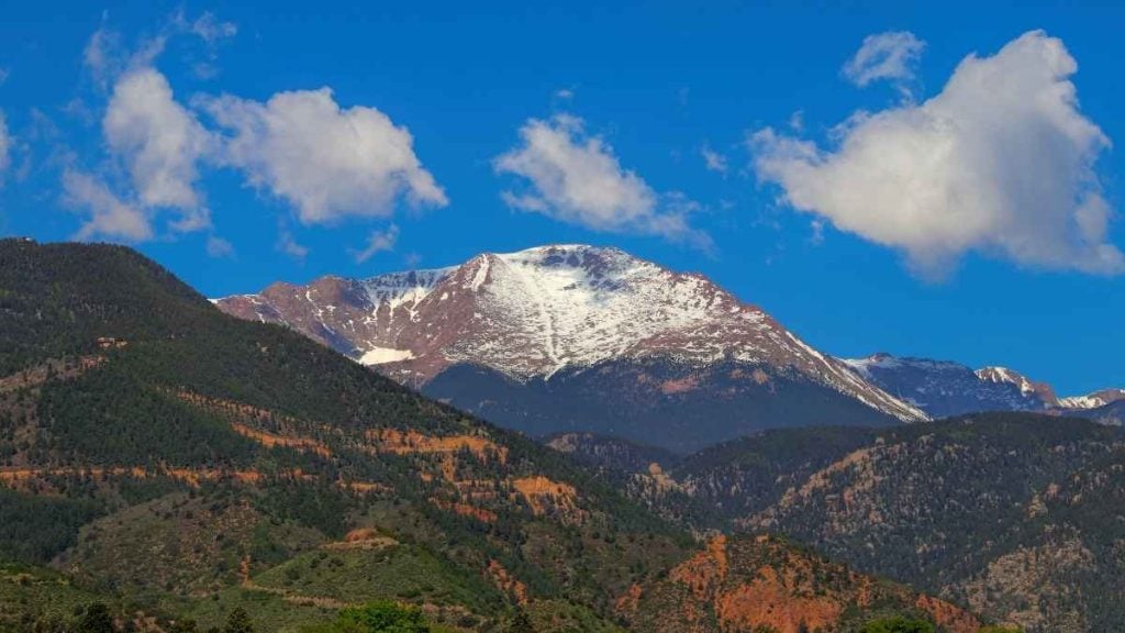
Are you ready to explore Pikes Peak, widely considered “America’s Mountain” in Colorado? The Pikes Peak Highway is one of the most awe-inspiring scenic drives in the US. Set 14,115 feet above sea level, Pikes Peak has to be one of the most dramatic American drives, offering breathtaking panoramic views at the summit.
Before you set off on your Colorado adventure and weave along the 19-mile paved toll road that climbs to the mountain’s summit, it’s worth brushing up on a few handy driving tips. In this guide, we explain how to get to Pikes Peak, the top stops along the highway, and tips for a safe and enjoyable drive. Trust us: there’s a reason the views are the top inspiration for the words of “America the Beautiful” by Katharine Lee Bates.
In this guide, we’ll be covering:
- Pikes Peak Highway: Overview
- How to get to Pikes Peak
- What to expect on the drive
- Top stops along the highway
- Ways to reach the summit (if not driving)
- Tips for a safe and enjoyable drive
- Frequently asked questions

Pikes Peak Highway: Overview
Built in 1915, the Pikes Peak Highway blends views of Colorado Springs with rugged mountain terrain, making it one of the most iconic scenic mountain roads in the US.
It’s even the home of the Pikes Peak International Hill Climb, an annual car and motorcycle race to the summit that has been running since 1916 (making it the second-oldest motorsport race in the US).
- Highway length: 19 miles (one way)
- Summit elevation: 14,115 feet above sea level
- Drive time: Approximately 1 hour up, 30–45 minutes down (without stops); allow 3 to 4 hours round trip with stops
- Admission (as of June 2026): $18 per adult (16+), $8 per child (ages 6–15); carload rate of $65 for up to 5 passengers. Note: prices subject to change, check before visiting.
- Timed-entry permit: A $2 timed-entry permit per vehicle is required for driving past Mile 7 (Memorial Day weekend through September 30)
- Highway entrance: Located in Cascade, Colorado, approximately 12 miles west of Colorado Springs via Highway 24
- Open: Year-round, weather permitting; always check conditions before heading up
How to get to Pikes Peak
Colorado Springs is the most common starting point for those visiting Pikes Peak. From Colorado Springs, drive 30 minutes west on Highway US-24, turn left onto Fountain Avenue, and you’ll see the signs for the Pikes Peak Highway.
Colorado is a handy spot to base yourself when visiting the Pikes Peak region. Consider booking accommodations and renting a car in Colorado Springs (but remember to fill up before you leave, as there are no gas stations on the highway).
Tip from the author: Make sure you have at least half a tank of gas before starting the drive. There are no fuel stops on the highway, and the high altitude means your engine works harder than usual.
What to expect on the drive
The drive to the summit of Pikes Peak (America’s mountain) is as much about the journey as it is the destination. Here are four things to know before you get behind the wheel.
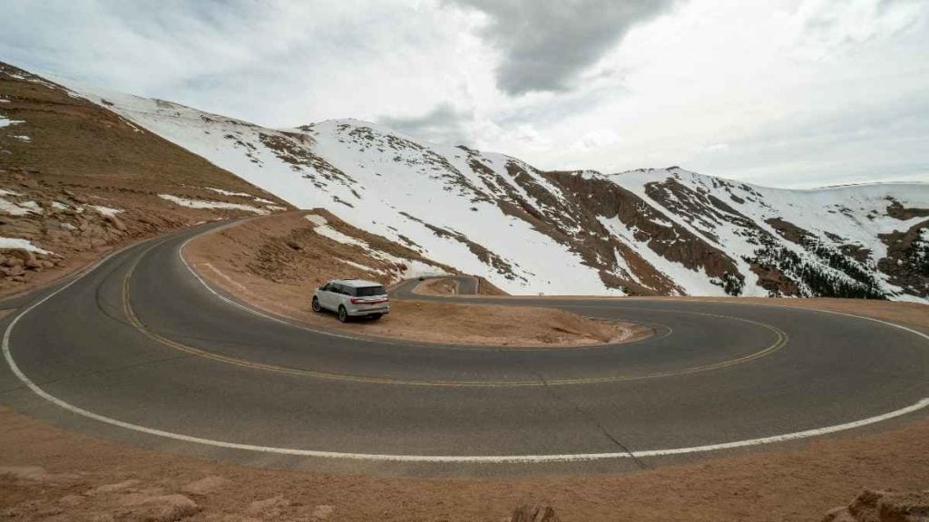
- The road conditions: While this high-altitude drive is fully paved and offers a two-lane road, it can be a thrilling experience. While not technically difficult, the road has steep drop-offs and over 150 tight switchbacks above the treeline that can feel intense for nervous drivers or those with a fear of heights. But the good news is that regular passenger vehicles are welcome (just make sure your brakes are ready for the steep descent!).
- The four life zones: As you climb Pikes Peak Highway, you’ll pass through four distinct ecological zones, from dense montane forests and subalpine woodlands to alpine tundra and the rocky, treeless summit above the timberline. Each looks and feels completely different: the dry woodland park and meadows give way to an alpine tundra zone that’s rocky, barren, and beautiful as you near the summit.
- Altitude effects: The summit sits at over 14,000 feet, where oxygen is significantly lower than at sea level. Many drivers and visitors experience altitude sickness symptoms as they ascend (including headaches, dizziness, nausea, and shortness of breath). One way to combat this is by spending a day or two at a lower elevation before driving up (particularly if you’re arriving from sea level).
- Weather conditions: Like most mountainous regions, the weather can change rapidly at altitude. In fact, the temperature at the summit is typically 30°F to 40°F cooler than at the base. Plus, summer afternoon thunderstorms are common, so aim to reach the summit by midday and begin the descent before early afternoon. Always check the weather and road conditions before departing.
Top stops along Pikes Peak Highway
Break up the drive and pull over at one of the top stops along the Pikes Peak Highway. Set aside at least 3 to 4 hours to complete the drive and avoid rushing between stops.
Crystal Reservoir (Mile 6)
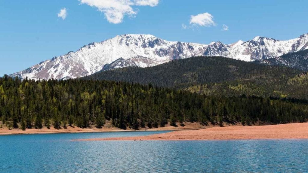
Once you reach mile 6, pull over for the first major stop of the Pikes Peak Highway drive. Crystal Reservoir is a scenic alpine reservoir situated at 9,230 feet above sea level. And as you’d expect, it offers incredible views of the mountain face above.
Swing by the visitor center for gift shopping, snacks, and access to restrooms. If you have a Colorado fishing license, consider bringing a rod to drop a line. If you’re ready to get active, consider renting a paddleboard or kayak at the reservoir (just check for any shoreline restrictions; ongoing dam repairs and fluctuating water levels may affect your visit, so check conditions before departing).
- Best for: A sparkling deep-blue alpine lake and a chance to stretch your legs.
- Don’t miss: As the gateway to the North Slope Recreation Area, Crystal Reservoir helps you reach nearby hiking and fishing spots at North and South Catamount Reservoirs.
Glen Cove Inn (Mile 13)
History buffs: Don’t miss Glen Cove Inn, a historic lodge perched just below the treeline at 11,425 feet (roughly the halfway point of the drive). This is where the mountain’s bald rocky summit first comes fully into view, often dusted with snow even in summer. Stop here for a hot meal, restrooms, and a gift shop. Plus, this is the location of the brake check station, where staff check vehicle brakes before the steeper upper section.
- Best for: Bringing the kids to pan for gold and visiting a historic rustic lodge.
- Don’t miss: Grabbing a bite to eat at Timberline Cafe or soaking up rays on the sunny patio.
Tip from the author: Glen Cove is the last chance for restrooms and food before the summit; make the most of the stop, especially if traveling with kids.
Devil’s Playground (Mile 16)
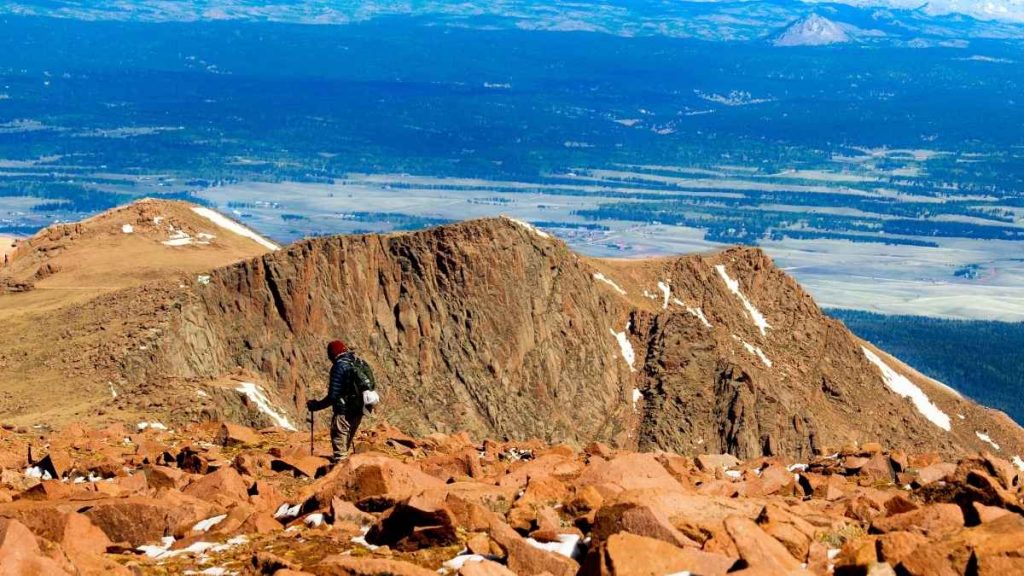
Here is where the terrain starts to take a dramatic turn. Located above the treeline at around 13,000 feet, Devil’s Playground is a boulder field brimming with yellow-bellied marmots and a great place to stretch your legs and take photos. The name comes from the lightning activity common in the area during afternoon storms (another good reminder to start your descent before midday in summer!).
Want to try hiking the final section? There is a shuttle stop and parking area located at Devil’s Playground for those ready to summit on foot.
- Best for: Hikers ready to summit Pikes Peak (it’s roughly 9 miles out-and-back).
- Don’t miss: A chance to spot local wildlife, from marmots to bighorn sheep grazing.
The Summit (14,115 feet)
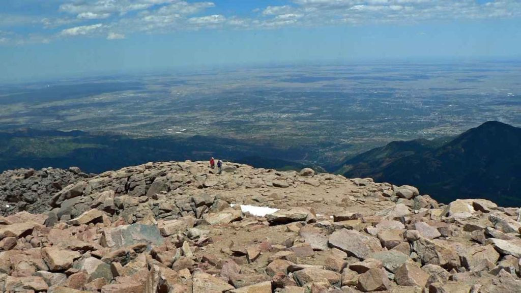
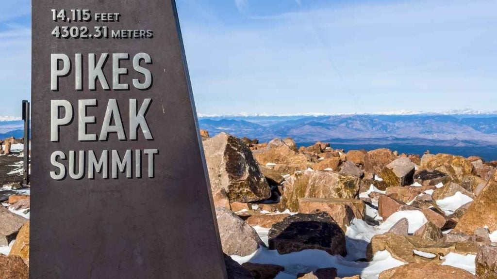
This is the stop everyone travels to see. The Pikes Peak Summit Visitor Center sits at 14,115 feet and offers panoramic views that (on a clear day) stretch across four states. Inside, you’ll find interactive exhibits about the mountain’s geology and history, and the famous high-altitude donuts. Fun fact: these are the only donuts in the world made at an altitude above 14,000 feet and are truly only of a kind, as the low air pressure causes them to puff up and fry perfectly.
- Best for: High-altitude sight-seekers, photographers, and sweet-tooth travelers.
- Don’t miss: Grabbing one of the 700 fresh donuts made every hour at the summit.
Tip from the author: The famous summit donuts are worth the hype, but don’t linger too long at altitude if you’re feeling the effects. The best way to feel better is to start descending.
Other ways to reach the summit
While driving along Pikes Peak Highway is a popular route, it’s not the only way to reach the summit. If you’d prefer to avoid driving (or white knuckling) the upper sections, here are a few other options to consider.
- Pikes Peak Shuttle: Available Memorial Day weekend through mid-September. Park at Mile 7 and ride a hop-on, hop-off shuttle with stops at Crystal Reservoir, Glen Cove Inn, Devil’s Playground, and the summit. Tickets sell out, so be sure to book online in advance.
- Guided tours: Several Colorado Springs tour operators offer guided vehicle tours to the summit, including jeep tours and narrated van tours. This can be a good option for those who want to focus on the views rather than the road.
- Hiking (Barr Trail): The 13.5-mile Barr Trail from Manitou Springs is the main hiking route to the summit. Keep in mind this is a serious all-day undertaking with 7,400 feet of elevation gain, so it’s recommended for experienced hikers only.
- Cycling: Cycling is permitted both up and down the highway for those who want a significant challenge. Several operators also offer shuttle-to-summit rides so cyclists can enjoy the descent only.
Tips for driving Pikes Peak Highway
Enjoy a safe, comfortable drive along Pikes Peak Highway to the summit with these driving tips.
- Start early: Aim to reach the summit before noon, as summer afternoon thunderstorms roll in quickly above the treeline and can close sections of the highway. Morning offers clearer skies and fewer crowds.
- Book your timed-entry permit in advance: From Memorial Day weekend through September 30, a timed-entry permit is required to drive past Mile 7. These sell out on busy summer days, so book ahead.
- Use low gear on the descent: The long downhill can put significant strain on your car’s brakes. Consider using engine braking (low gear) rather than riding the brakes continuously to ease the strain. Plus, stop in at Glen Cove’s brake check station on the way up to have your brakes inspected.
- Bring layers: Summit temperatures can be 30°F colder than at the base, so be sure to pack a jacket regardless of how warm it feels when starting the drive up.
- Choose the right vehicle: Any standard passenger vehicle can make the drive, but a reliable car with good brakes is important. Browse Turo for a wide range of vehicles in Colorado Springs.
Want to keep the Colorado road trip going? Spend the night in Denver and consider the Denver to Telluride road trip guide.
Frequently asked questions about driving Pikes Peak
Is it safe to drive up Pikes Peak?
Yes, it’s safe to drive up Pikes Peak as the highway is fully paved and open to regular passenger vehicles. The road is only open when conditions are safe; if the weather makes driving dangerous, the highway closes. Keep in mind that the upper sections have steep drop-offs and tight switchbacks, which can feel intense for nervous drivers. Using low gear on the descent and stopping at the Glen Cove brake check station are the key safety steps.
How long does it take to drive Pikes Peak?
Driving Pikes Peak takes approximately 1 hour up and 30–45 minutes down without stops. However, most visitors spend 3–4 hours total to allow time for stops, photos, and time at the summit. A full half-day is a comfortable amount of time to enjoy the experience without rushing.
How much does it cost to drive Pikes Peak Highway?
As of June 2026, the costs of visiting Pikes Peak are: $18 per adult (16+), $8 per child (ages 6–15), with a carload rate of $65 for up to 5 passengers. A $2 timed-entry permit per vehicle is also required from Memorial Day weekend through September 30. Prices are subject to change, so check online for the current rates.
When is the best time to drive Pikes Peak?
Summer (June through September) is peak season at Pikes Peak; the highway is fully open, and all visitor services are operating. Early morning departures are strongly recommended to avoid afternoon thunderstorms. Late May and early October offer fewer crowds and mild weather, though conditions can be more variable. The highway is open year-round, but upper sections may close in winter.
Can a regular car drive up Pikes Peak?
Yes, the road to the top of Pikes Peak is fully paved and accessible to standard passenger vehicles. Any reliable car (whether that’s your own vehicle or a rental car) with good brakes can make the drive. Be aware that the engine works harder at high altitude, and the descent puts strain on the brakes, so using low gear and stopping in at Glen Cove for a brake check are both recommended.
Ready to drive America’s Mountain?
Ready to experience the Pikes Peak drive for yourself? Whether you stop at the reservoir, linger at the summit, or simply marvel at how quickly the world falls away below, a drive up America’s Mountain is a morning well spent.
Colorado Springs is the natural base for the drive. Browse Turo for a car to rent in Colorado Springs or Denver, with flexible pick-up options and a wide range of vehicles to suit your trip.

Share your car, earn extra cash
Cover your car payments or earn some extra cash by sharing your car whenever you’re not using it.
Get startedHit the road
Browse thousands of cars for every occasion and budget near you, or wherever you’re going.
Browse cars
Lucinda Starr
Lucinda Starr is a travel and automotive writer with 5+ years of firsthand experience road-tripping across Australia, New Zealand, and beyond. She writes road trip guides for Turo, drawing on her experience behind the wheel to share practical insights on long-distance drives, destinations, and vehicles. Her travels have taken her across Australia’s East Coast, Victoria’s Great Ocean Road, the Northern Rivers, Byron Bay, and both islands of New Zealand. One of her most memorable journeys was an 11-day, 2,600+ km route from Auckland to Punakaiki and Queenstown. Lucinda has a particular passion for classic, rugged 4WD vehicles and the freedom they bring to exploring new places.