posted on October 9, 2026
Stretching for 90 miles along Highway 1 from Carmel-by-the-Sea to San Simeon, the Big Sur drive is one of America’s great coastal adventures. Venture along the California coast and you’ll be treated to the famed Bixby Creek Bridge, the stunning 80-foot waterfall at McWay Falls, and the striking purple sands of Pfeiffer Beach.
With so many natural wonders and diverse landscapes to explore, it’s best to set aside at least a couple of days to tackle the Big Sur road trip. Before you hit the road, brush up on driving conditions, where to find gas stations, and the top places to pull over and explore along the way.
In this guide, we’ll be covering:
- Big Sur drive: An overview
- Road trip map from Carmel to San Simeon
- Top tips for driving along the Big Sur coast
- Your stop-by-stop Big Sur drive itinerary
- Top places to stop along the Big Sur drive
- Frequently asked questions about the Big Sur drive
An overview of the Big Sur drive
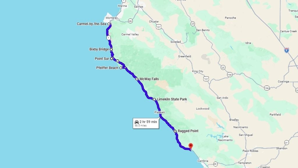
- Drive time: ~3 hours (direct route)
- Drive distance: ~90 miles (direct route)
- Suggested road trip length: 1 to 3 days
- Recommended itinerary:
- Stop 1: Carmel to Bixby Creek Bridge (~15 miles)
- Stop 2: Bixby Creek Bridge to Point Sur (~6 miles)
- Stop 3: Point Sur to Andrew Molera State Park (~8 miles)
- Stop 4: Andrew Molera to Pfeiffer Beach (~5 miles)
- Stop 5: Pfeiffer Beach to McWay Falls (~12 miles)
- Stop 6: McWay Falls to Limekiln State Park (~7 miles)
- Stop 7: Limekiln State Park to Ragged Point (~30 miles)
- Stop 8: Ragged Point to San Simeon (~20 miles)
- Top stops: Bixby Creek Bridge, McWay Falls, Pfeiffer Beach
- Gas stations along the drive: Sparse south of Big Sur Village and notoriously expensive; aim to refuel in Carmel if you’re heading south or Cambria if you’re tackling this route in reverse
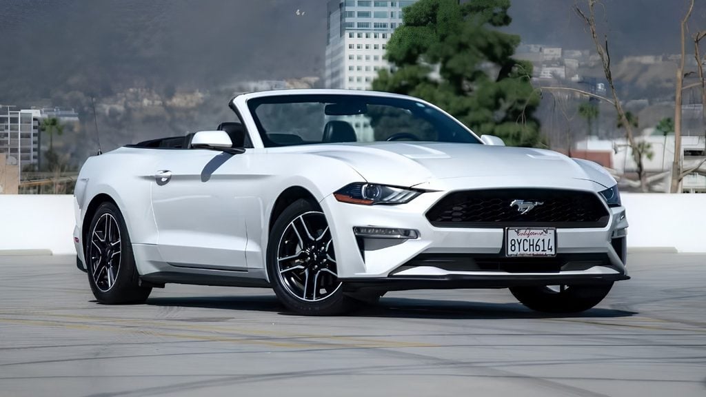
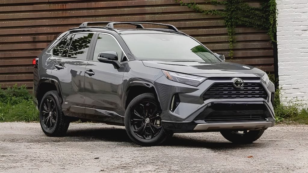
- Driving conditions and recommended vehicle: Expect a narrow, winding two-lane road; a comfortable, easy-handling car matters more than size. Compact SUVs (like the Toyota RAV4), sedans (like the Honda Civic), or convertibles (like the Ford Mustang) are nimble, responsive, and perfect for a California road trip.
Distance from Carmel to San Simeon
The Big Sur drive from Carmel to San Simeon covers roughly 90 miles, running along Highway 1 hugging the Californian coastline. Most drivers start in Carmel-by-the-Sea and drive south to San Simeon/Cambria; this keeps the ocean views unobstructed for the driver on the right-hand side and makes detouring to scenic pullouts easy.
Big Sur drive time
It’s technically possible to tackle the Big Sur road trip in three hours (one-way). But this driving route is packed with amazing views across the Pacific Ocean, meaning most travelers tend to build in multiple stops along the way. Set aside at least 5-8 hours for this drive as a full-day trip, or split it across two to three days for a more relaxed driving experience.
Keep in mind that while the speed limits on most roads are 55 mph, many of the U-shaped switchbacks require you to significantly reduce speed (sometimes as low as 15 to 20 mph), which can add to your overall drive time. Heavy morning fog in summer (July and August) and winter rain can reduce visibility and cause delays, too.
When to go on the Big Sur drive
Fall (September and October) is the best time to tackle the Big Sur drive, offering warm temperatures, light winds, and the clearest skies of the year. Best of all, you’ll skip the thick summer marine fog to give yourself the best chance of sparkling postcard views across the Pacific Ocean.
Expect coastal fog in summer (especially in the mornings), blooming wildflowers in spring, and cooler temperatures in winter (plus shorter business hours).
The best stop on the Big Sur drive
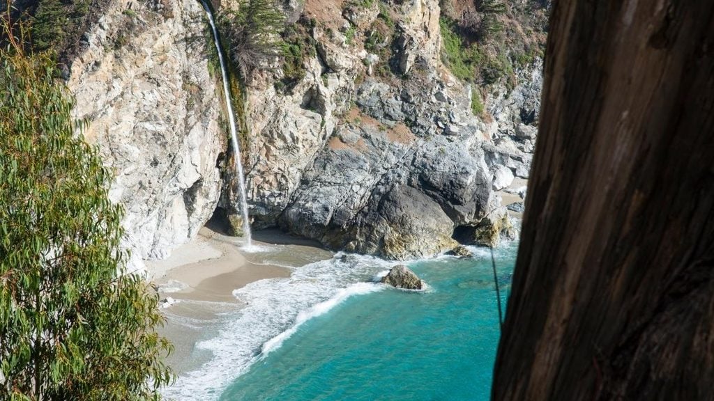
McWay Falls is roughly halfway on the Big Sur drive and offers one of the most iconic sights on the route. It’s an ideal stop offering a short walk to the scenic overlook, giving you a front-row seat at the 80-foot waterfall cascading directly into the turquoise cove below.
Road trip map from Carmel to San Simeon
Top tips for driving along the Big Sur coast
Gearing up to visit Big Sur? The most important thing to remember: fill up your tank completely in Carmel or Cambria before hitting Highway 1; gas stations are expensive and hard to find along this 90-mile stretch. Also, expect to lose phone signal entirely on this road trip, so download offline maps and bring printed hiking guides if you’re hitting the Garrapata State Park Bluff Trail (or any other hiking trails along the drive).
Driving conditions: What is Highway 1 like through Big Sur?
- Highway 1 through Big Sur has a history of road closures due to landslides, storm debris, and wildfire; always check current Caltrans road conditions before departure
- Narrow, winding two-lane road with sharp curves and steep drop-offs in places
- Coastal fog common in mornings and summer months, reducing visibility
- Cell service is unreliable through much of the route; offline maps are essential
- Popular pullouts (especially near Bixby Creek Bridge) fill up quickly on weekends
Recommended type of car for the Big Sur drive
Highway 1 involves tight switchbacks, steep cliff drop-offs, and narrow lanes, meaning a compact SUV or nimble sedan is the best vehicle for the Big Sur drive. The Toyota RAV4 and Subaru Outback offer an ideal higher seating position, improving visibility and offering the best ocean views over the roadside guardrails.
Looking for something a little more memorable? A convertible like the Ford Mustang, Mazda MX-5 Miata, or even a soft-top Jeep Wrangler lets you experience the fresh coastal air throughout the drive.
Browse car rentals in California, with a wide range of vehicle makes and models ready to book for your trip.
How to stay safe on this road trip
The Big Sur drive is incredibly scenic, but drivers need to stay fully focused on the road. Blind corners, sheer cliffs, and narrow roads mean it’s important to slow down, leave space between yourself and other vehicles, and keep your eyes on the road. To stay safe on the drive:
- Pull over only at designated turnouts and never stop in the road for photos
- Watch for cyclists; Highway 1 is a popular cycling route
- Fuel up before starting; stations are sparse south of Big Sur Village
- Download offline maps given limited cell service
- Drive with headlights on for better visibility in frequent fog
The perfect Big Sur drive itinerary
The best Big Sur driving itinerary runs south from Carmel-by-the-Sea to San Simeon, stopping at cliffside lookouts, ancient redwood trails, and iconic architectural landmarks along the way.
Stop 1: Bixby Creek Bridge
- Drive time: ~20 minutes from Carmel
- Drive distance: ~13 miles
- What to do: The most photographed spot on the route; the south-side pullout offers the classic bridge-and-coastline shot
- Where to eat: Rocky Point Restaurant (cliffside views, good early stop) or Nepenthe (their famous Ambrosia Burger is a must, best enjoyed alfresco on their sprawling outdoor terrace)
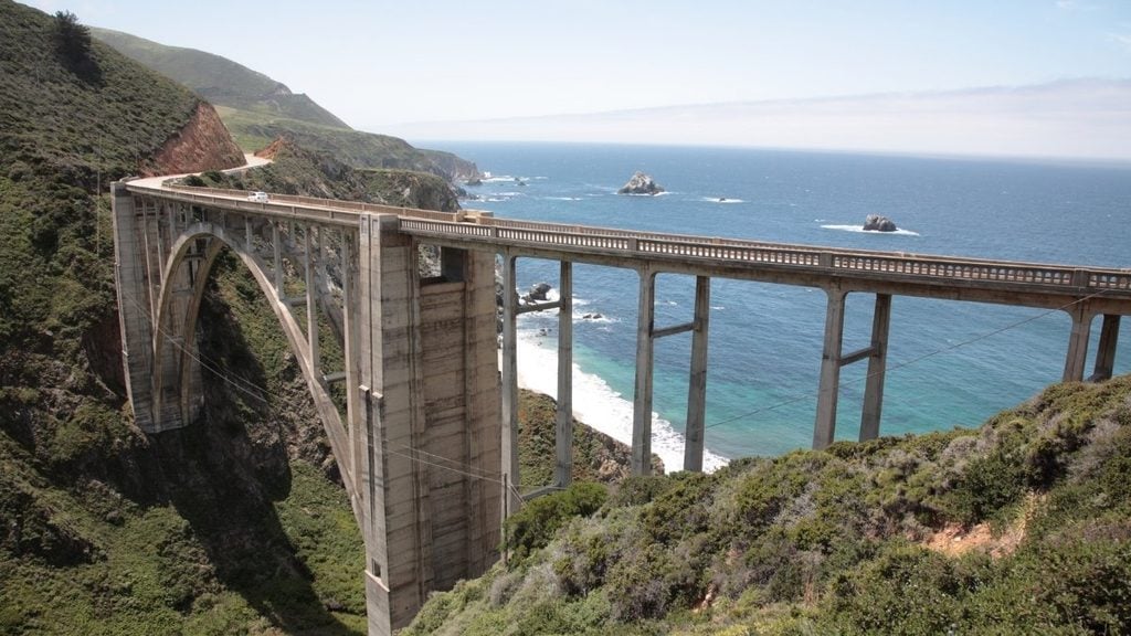
Set off early and pull over at the architectural masterpiece that is the Bixby Bridge (best photographed early before the crowds arrive). This open, arched bridge stands 280 feet above the canyon where Bixby Creek meets the Pacific Ocean. In fact, you might recognize the bridge’s dramatic silhouette from the opening credits of HBO’s TV series Big Little Lies.
Stop 2: Point Sur
- Drive time: ~10 minutes from Bixby Creek Bridge
- Drive distance: ~6 miles
- What to do: Point Sur Lightstation, an 1889 lighthouse perched on volcanic rock, connected to land by a sandbar; guided tours available by reservation
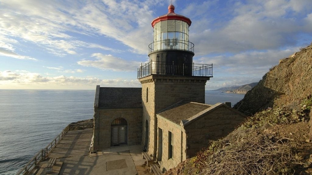
Just a short drive down the road, you’ll reach Point Sur State Historic Park. Situated on an incredible 361-foot volcanic rock jutting straight out into the ocean, this spot offers some of the most dramatic views of the entire drive.
Here, you’ll find a fully preserved 19th-century village, an ideal whale-watching perch in spring, and Point Sur Lighthouse (one of the only remaining light stations open to the public in California, located within Big Sur State Park). Keep in mind you must book a 3-hour guided walking tour led by local volunteers to access the lighthouse, as it’s a protected historical site.
Stop 3: Andrew Molera State Park
- Drive time: ~12 minutes from Point Sur
- Drive distance: ~8 miles
- What to do: Some of the best hiking in Big Sur; the Discovery Center has info on the region’s California condor recovery efforts (a local endangered species)
- Where to eat: Big Sur Deli or Big Sur Tap House
As the largest state park along the Big Sur coast, a hike through Andrew Molera State Park is a must during your road trip (and a great way to stretch your legs). Kick off your hike with a scenic crossing of Big Sur River (expect to wade through knee-deep water, unless you’re visiting from June to October when the seasonal footbridge is installed) before tackling the Creamery Meadows Trail to Molera Beach. This beach is one of the best surfing spots in Big Sur, and its purple-sand coastline is covered in huge driftwood formations.
Stop 4: Pfeiffer Beach
- Drive time: ~10 minutes from Andrew Molera
- Drive distance: ~5 miles
- What to do: Known for its purple-tinted sand and Keyhole Rock; the access road (Sycamore Canyon Road) is an easy-to-miss unmarked turnoff
- Where to eat: Big Sur Roadhouse or Fernwood Tavern
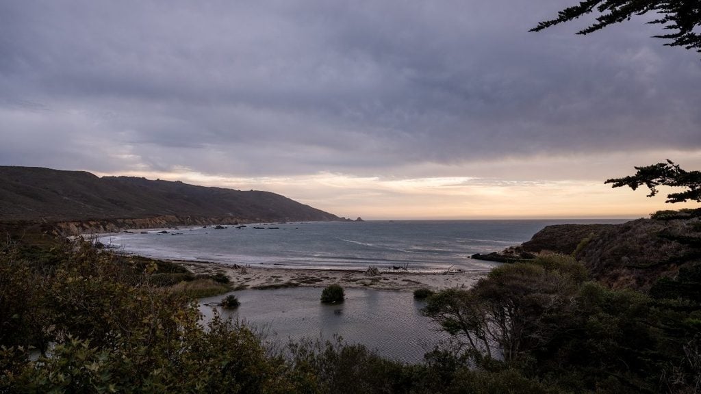
Just down the road, you’ll find one of the most magical spots on the Big Sur drive. Pfeiffer Beach is hidden down an unmarked road, and the beach is famed for its purple sands and the massive keyhole arch rock formation, a hot spot for photographers. Sycamore Canyon Road is incredibly narrow and winding, meaning RVs and motorhomes are prohibited.
After a day at the beach, head to the Big Sur Valley area to stay for the night. The Big Sur Inn and Deetjen’s Big Sur Inn are boutique hotel options to consider, or rent a rustic cabin at Pfeiffer Big Sur State Park Campground.
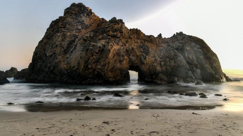
Tip from the author: The parking lot at Pfeiffer Beach is particularly small, so aim to arrive before 10 am or visit in the late afternoon (after 4 pm) for the best chance of securing a spot.
Stop 5: McWay Falls (Julia Pfeiffer Burns State Park)
- Drive time: ~20 minutes from Pfeiffer Beach
- Drive distance: ~12 miles
- What to do: An ~80-foot waterfall dropping directly onto the beach, offering the single most iconic image of the drive; short, easy overlook trail (currently closed; check the California State Parks website for the latest details)
- Where to eat: Nepenthe Restaurant or Sierra Mar Restaurant
Wake up bright and early to start your day with a visit to McWay Falls (one of the only tidefalls on Earth, with a waterfall pouring directly into the ocean). While the beach below is closed to the public, you can soak in views of the waterfall from designated roadside viewing turnouts dotted along Highway 1.
Stop 6: Limekiln State Park
- Drive time: ~12 minutes from McWay Falls
- Drive distance: ~7 miles
- What to do: Waterfall, old-growth redwoods, and beach access in one stop; historic 19th-century lime kilns on the trail
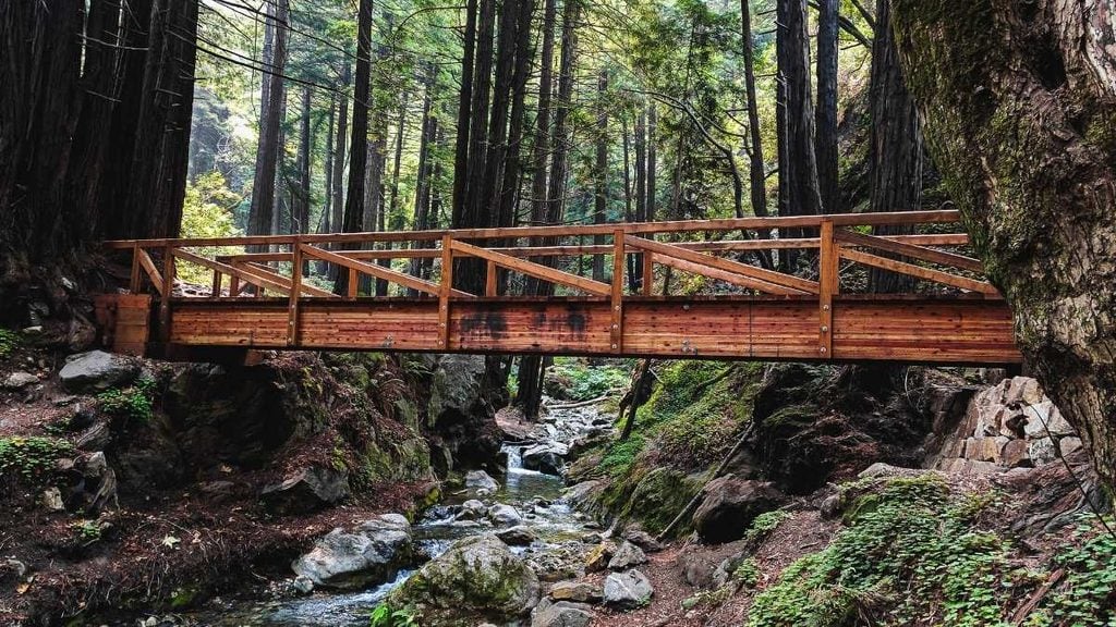
A short drive away, you’ll find Limekiln State Park, boasting towering redwoods, historic ruins, and a beach just off Highway 1. Several short hikes (like the Limekiln Ruins Trail and Pitkins Curve Trail) are open, but the park’s popular 100-foot waterfall trail is closed due to unstable trees and fire damage.
Stop 7: Ragged Point
- Drive time: ~40 minutes from Limekiln (longer, sparsely populated stretch)
- Drive distance: ~30 miles
- What to do: Dramatic clifftop viewpoint near the southern end of the route, good spot for a break before the final stretch
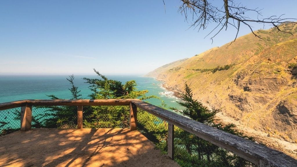
From Limekiln, settle in for the longest stretch of the drive, about 40 minutes with barely a building in sight. Ragged Point makes a welcome break, perched right at the edge of a dramatic clifftop with sweeping views back up the coast you’ve just driven. There’s a gas station here too (one of the only ones for miles), so it may be worth topping off before tackling the final leg to San Simeon.
Stop 8: San Simeon
- Drive time: ~25 minutes from Ragged Point
- Drive distance: ~20 miles
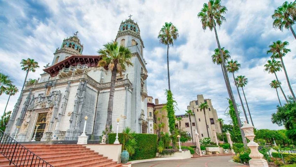
- What to do: Trip endpoint; Hearst Castle is a worthwhile add-on for those with extra time
The final stretch from Ragged Point eases off the switchbacks as the road opens back up near San Simeon, marking the end of the Big Sur drive. This laid-back beach town makes a fitting place to catch your breath. If you’ve got an extra day up your sleeve, it’s worth detouring inland to tour Hearst Castle, the opulent hilltop estate that’s one of California’s most-visited historic landmarks.
Before heading home (or continuing south), grab a bite at Sebastian’s General Store or Fins Restaurant, both local favorites for fresh seafood with ocean views.
Top places to stop along the Big Sur drive
Narrow down your Big Sur itinerary with these top places to see along the way.
Top stops for nature lovers
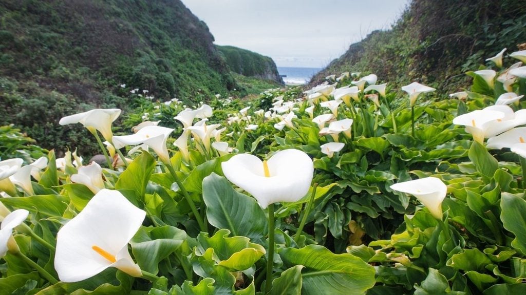
- Garrapata State Park: Home to the seasonal Calla Lily Valley trail, Garrapata offers rugged cliffs, tide pools, and easy sandy beach access without needing to detour far off Highway 1.
- Partington Cove: Reached via a short trail through a hidden tunnel, this rocky cove has calm turquoise water and is one of the better spots on the drive to catch sea otters at play.
- Sand Dollar Beach: The largest stretch of sandy beach on the Big Sur coast, it’s an easy scenic pull-off for a picnic or a stretch before tackling the next leg of the drive.
- Hurricane Point: One of the most dramatic viewpoints on the whole route, with sweeping views back toward Bixby Creek Bridge.
Top stops for foodies
- Big Sur River Inn & Restaurant: A Big Sur institution set right on the river, known for its creekside deck dining and hearty comfort food.
- Deetjen’s at Big Sur Inn: A historic 1937 roadhouse tucked among redwoods, best known for one of the most charming breakfast spots on the whole route.
- Big Sur Bakery: A local favorite for wood-fired pizzas and fresh pastries, all baked on-site daily.
- Café Kevah: Nepenthe’s laid-back sister café, with an open-air terrace that’s a great spot for coffee and a bite with an ocean view minus the crowds.
Top stops for families
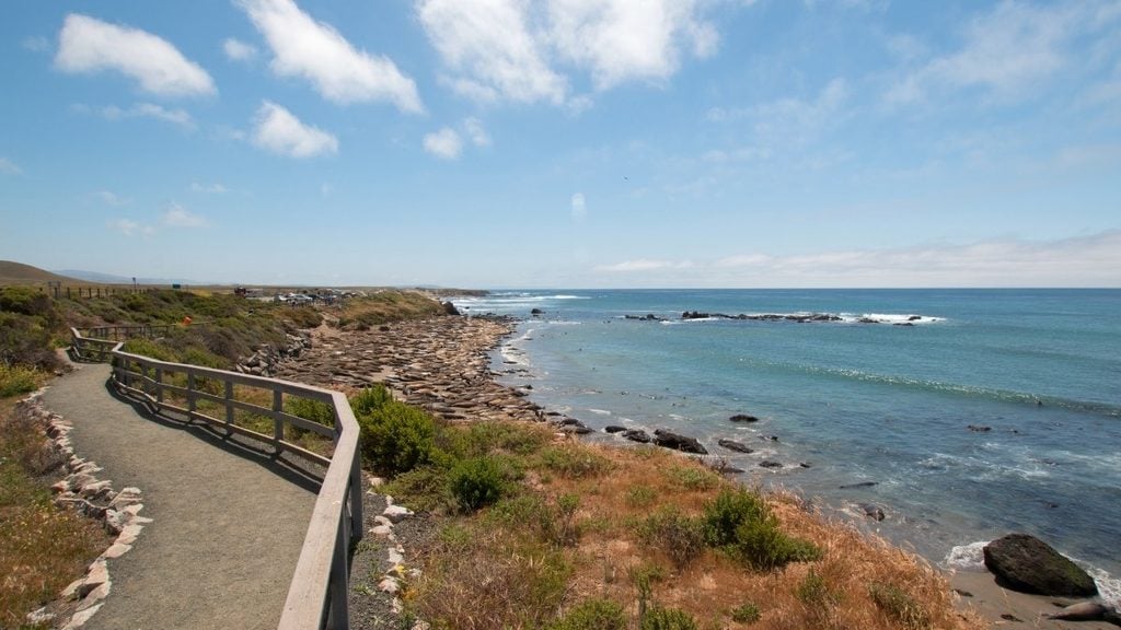
- Piedras Blancas Elephant Seal Rookery: A free roadside stop just past San Simeon where you can watch wild elephant seals lounging on the beach, busiest during pupping season (December–March).
- Henry Miller Memorial Library: Part bookshop, part community gathering spot under the redwoods, with an easy-going outdoor deck that’s a nice break for restless kids.
- Pfeiffer Falls Trail: An easy 2-mile round-trip walk through redwood groves to a 60-foot waterfall, one of the best family-friendly hikes in Big Sur.
Frequently asked questions about the Big Sur drive
Is Highway 1 through Big Sur open right now?
Highway 1 has a history of closures due to landslides, storm damage, and wildfire, so conditions can change quickly. Always check the current Caltrans QuickMap or road conditions page before setting off, especially if you’re traveling in winter.
Is it worth driving through Big Sur?
Yes; Big Sur is widely considered one of the most scenic coastal drives in the US, packed with dramatic cliffs, waterfalls, and beaches along a single 90-mile stretch of Highway 1.
How many days does it take to drive through Big Sur?
You can drive the direct route through Big Sur in around three hours (one-way), but most travelers set aside one to three days to properly explore the stops along the way.
Can you drive Big Sur in reverse (San Simeon to Carmel)?
Yes, the route works well in either direction. Driving north from San Simeon puts the ocean views on the passenger side rather than the driver’s, so keep that in mind if unobstructed photo opportunities matter to you.
Can I fly instead of driving to see Big Sur?
Not really; there’s no commercial airport in Big Sur itself. The nearest options are Monterey Regional Airport to the north or San Luis Obispo County Regional Airport to the south, meaning renting a car is still the easiest way to experience the drive and explore the region.
Final word: Planning the Big Sur drive of a lifetime
Whether you’re chasing the perfect shot of Bixby Creek Bridge at sunrise or planning to wade across Big Sur River on your way to a purple-sand beach, the drive from Carmel to San Simeon delivers something different around every bend. Few stretches of coastline pack in this much (towering redwoods, cliffside waterfalls, historic lighthouses, and elephant seals lounging just off the highway) in just 90 miles.
Ready to hit Highway 1? With Turo, booking the right rental car in Monterey is easy: choose from a wide range of vehicles, from nimble sedans and compact SUVs to convertibles, all suited to Big Sur’s winding coastal roads.
Share your car, earn extra cash
Cover your car payments or earn some extra cash by sharing your car whenever you’re not using it.
Get startedHit the road
Browse thousands of cars for every occasion and budget near you, or wherever you’re going.
Browse cars
Lucinda Starr
Lucinda Starr is a travel and automotive writer with 5+ years of firsthand experience road-tripping across Australia, New Zealand, and beyond. She writes road trip guides for Turo, drawing on her experience behind the wheel to share practical insights on long-distance drives, destinations, and vehicles. Her travels have taken her across Australia’s East Coast, Victoria’s Great Ocean Road, the Northern Rivers, Byron Bay, and both islands of New Zealand. One of her most memorable journeys was an 11-day, 2,600+ km route from Auckland to Punakaiki and Queenstown. Lucinda has a particular passion for classic, rugged 4WD vehicles and the freedom they bring to exploring new places.